Rim Rock
National Recreation Trail
Shawnee National Forest
Trail Guide
Rim Rock National Recreation Trail is a premier recreation area in the Shawnee National Forest in southern Illinois.
Rim Rock offers multiple hiking opportunities, historical sightseeing, nature viewing, scenic overlooks, and other solo and outdoor group activities.
Rim Rock is also close to Pounds Hollow, providing visitors with camping and swimming beach possibilities.
To learn more about the Rim Rock National Recreation Trail in the Shawnee National Forest, this guide was created for you to use and enjoy.
Directions to Rim Rock National Recreation Trail
Getting to Rim Rock is very easy. All roads leading to the trailhead are paved and in good condition for all vehicles. The trailhead is in good condition and easy to drive into and park.
To reach the trailhead, see this Google Maps page for detailed instructions on getting to Rim Rock from Interstate 57, located in Marion, Illinois. This route is about 50 miles, about an hour of driving.
Be sure to stop in Harrisburg or nearby Eldorado to fill up on fuel. These communities usually have some of the cheapest gas prices in southern Illinois. These communities also have more shopping areas to choose from before getting into the Shawnee Forest Country and away from all the businesses.
There is plenty of parking at the trailhead, including handicap parking and bus parking. There are no electric-car hookups located at this trailhead.
Trail and Activity Information for Rim Rock National Recreation Trail
Once you arrive at Rim Rock National Recreation Trail, you are offered a few trails and outdoor activity options at the trailhead.
As of the creation of this guide, there is a partial trail closure in this area. These are the stairs leading down into the “maze.” You can walk to the platform where the stairs are and view the scenic overlook. You can take the easternmost trail down to the bottom of the bluff and go left at the junction to reach the “maze” as an alternative route.
Please do not use the stairs while that portion of the trail is closed – doing so is hazardous to your safety and against the forest regulations. You could be fined or even arrested for failing to abide by this closure.
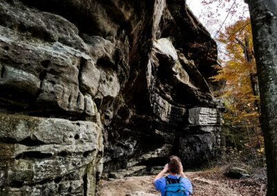
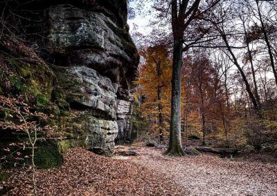
Westernmost Trail – The westernmost trail starts at the trailhead (left of the signage) and will take you to the observation deck and staircase leading down into the “maze” of the recreation trail. The stairs are currently closed, and there is no ETA on when they will reopen. You can still hike to the observation deck and past the stairs to make it a loop back to the trailhead. The hike will be less than a mile and relatively easy. There is a lot to see along this route, including bluff tops with scenic overlooks, an ancient Native American rock wall (also called a Stonefort), and signs from previous settlements and the occupation of early pioneer settlers.
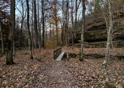
Middle Trail – The middle trail is the fastest way to get to the better viewing area for the Native American rock wall structure (called a Stonefort). Interpretive signage exists along the way to inform you about the history of the area and the Stonefort. Continue going down the middle trail to loop past the closed staircase down the bluff. The trail is easy and less than one mile in length.
Easternmost Trail – Currently, this is the only designated trail leading down to the bottom of the bluff. There is more to see along this trail. That includes natural shelters, Ox Lot Cave (interpretive signage present), an active spring at the cave, the “maze” system to the west of the save, a scenic creek, bluffs, and more. This out and back trail will be a little over a mile in length and is considered moderately difficult.
Pounds Hollow Junction – Once you get to the bottom of the bluff on the easternmost trail, you’ll arrive at a junction where you can go left for Ox Lot Cave or right for Pounds Hollow. If you go right, it provides an out and back trail (about 1 mile long, moderately rugged) that will take you to Pounds Hollow Beach. Be sure to bring a swimsuit if you plan to swim. Swimming at the beach is currently free.
Picnicking – Picnic tables and grilling features at the Rim Rock National Recreation Trail Trailhead on the western side of the parking area. Please make sure all fires are cold to touch before leaving them unmanaged.
Restrooms – There are vault toilets available at the trailhead. There are toilets with running water available at Pounds Hollow Beach.
Trash Services – There are no trash services at Rim Rock National Recreation Trail. Please pack out what you pack in and leave the area better than you found it.
Camping – Camping is not allowed at the Rim Rock National Recreation Trail. However, you may camp next to the trail at Pounds Hollow. There are 13 electrical and 42 non-electrical sites at the campground, open from March 15 to December 15. Camping is currently $10 for electric or non-electric. A proposed fee increase for electric sites is currently in the process of being completed.
Maps and Information: US Forest Service | All Trails
Essential Tips for Visiting the Rim Rock National Recreation Trail
This area is for hikers only. Horseback riders, bicycles, and motor vehicles of any kind are prohibited.
Help keep Rim Rock clean for all visitors by packing out what you pack in and by leaving the area better than you found it.
Please abide by all closures in place. These closures are meant to protect members of the public. Failing to comply with the closures can result in being asked to leave, fines, and even arrest by US Forest Service Law Enforcement.
Please don’t stack rocks. Rock stacking promotes significant damage to ecosystems of wildlife and critters that live in the forest and need its elements to survive. Rock stacking damages ecosystems and removes the natural beauty from the area.
Pets are allowed if on a leash.
Please watch your step as dangerous areas exist at Rim Rock. People have become injured and even died near this area from falls on top cliffs and bluffs.
Venomous snakes, poison ivy, and biting insects occur in this area. Avoid these hazards by watching your step.
Please stay on the trail at all times.
Please call the US Forest Service Law Enforcement Tips Line to report suspicious behaviors at 618-201-3364. You can remain anonymous if you wish to.
In the event of an emergency, please call 911.
Lodging, Dining, Shopping, and Sightseeing Nearby
There are many great options nearby to the Rim Rock National Recreation Trail for lodging, dining, shopping, and sightseeing.
For camping, consider Pounds Hollow, which provides electric and non-electric sites. You can also lodge in our local cabins. Rim Rock Dogwood Cabins are pet-friendly and across the road from Rim Rock. There are also Timber Ridge Treehouse Cabins and Shawnee Forest Cabins which are both also very close to Rim Rock. For equine camping, check out Camp Cadiz for non-electric sites or Double M Campground for better options.
Check out the area’s famous Red Onion in Equality for nearby dining options. Cave-in-Rock State Park also offers a lodge for dining, trails, and recreational opportunities. Visit Harrisburg for more dining options.
For fuel, fast food, and other purchases – check out Harbison’s Country Store, which is the last place to get gas in the area. Garden of the Gods Outpost carries Shawnee Forest souvenirs, Bigfoot stuff, hiking, camping supplies, and some of the best soft serve ice cream. They even have ice cream treats for dogs.
Other recreational and sightseeing opportunities in the area include the Garden of the Gods Observation Trail and Wilderness Area, High Knob, and Iron Furnace. The creek across from Iron Furnace is a popular wading and swimming hole so that you know. Please exercise caution at all times when visiting these areas.
More information about this trail and others can be found and requested on the Southern Illinois Hiking & Outdoor Recreation Facebook group.
Watch the videos for this trail!
Below is a recent video that we filmed while enjoying this area.
Please Support Hiking with Shawn
Alrighty folks, I hope you have enjoyed this content. I provide it for free and it takes a while to create. If you would be so kind enough to support my efforts, you can do so by sharing this post with others, especially on social media. Be sure to subscribe to my YouTube Channel to see my latest videos, shorts and live streams. Follow me on Facebook, Instagram, Twitter and TikTok for unique content that you will only find on those pages. You might also join my Southern Illinois Hiking & Outdoor Resources Group on Facebook, too!
You can also support me by becoming a Patreon Supporter for as little as $3/month and you can cancel anytime (no contracts or catches). Patreons get access to extra features, exclusive articles, sticker packs, gifts and more. Consider buying official Hiking with Shawn Merchandise as another way to support me. I spend a lot of money on Hiking with Shawn and because of extremely high public land permit fees, I make very little money in return so everything helps.
Thanks again for checking out another one of my articles and until next time, I’ll see you on the trail!

Shawn Gossman
Founder, Hiking with Shawn
Howdy folks! My name is Shawn Gossman and I founded Hiking with Shawn. I’m an avid hiker, cyclist and outdoorsman here in the Shawnee National Forest. I was born and raised in Southern Illinois and never want to leave. I hope you enjoy my website and I encourage you to interact with me!


