Lower Cache River Area Guide
The Lower Cache River area is a section of the Cache River State Natural Area that might not be as often visited as much as places like Heron Pond and Wildcat Bluff.
It’s a wonderful area that truly offers multiple types of outdoor recreation opportunities. There are a few hiking trails, with one being accessible for handicapped users. There is a canoe/kayak launching area where paddlers can visit a state champion tree. There are also other opportunities, such as picnicking, wildlife watching, and nature viewing.
If you haven’t visited the Lower Cache River area in Southern Illinois yet, continue reading this Area Guide for more information on how to visit this wonderful spot today.
Lower Cache River Overview
The Lower Cache River area is an Illinois Department of Natural Resources-managed public land area near Ullin, Illinois.
There are two out-and-back hiking trails. There is also a water trail for kayaking and canoeing. Kayaks and canoe rentals and guide services can be obtained from Cache Bayou Outfitters nearby. One trail, which is handicap accessible, leads to an observation deck where you can see a state-champion cypress tree.
The longer hiking trail is 2.5 miles in length. The accessible trail to the observation deck is around 1,000 feet in length. The canoe trail is around 3 to 6 miles in length.
The 2.5-mile hiking trail is moderately difficult. The 1,000-foot accessible trail is easy. The 3 to 6-mile river trail is considered moderately difficult for paddlers.
There is little to no elevation gain in the Lower Cache River area.
Allow you a couple of hours to hike both trails and 2-5 hours to paddle the 3 to 6-mile river trail.
The best seasons to visit this area depend on what you want to get out of it. Each season brings a different view and feature to this area. During the spring, you can see wildflowers and wildlife start to come out of migration. The fall brings beautiful fall colors, and the winter leaf-off months allow you to see everything in the area with no biting insects as a bonus.
Pets are allowed if on a leash. Users should clean up after their pets. Do note that venomous snakes occur in this area and could be hazardous for unattended pets and children. Please make sure to watch their steps as well as your own.
There is ample parking for vehicles, including those carrying trailers for transporting small boats, kayaks, and canoes. The road and parking area are paved but may not be treated or cleared during wintry weather conditions. The area may flood during flash flooding conditions. There is a boat ramp and parallel dock provided at the location. There is a vault restroom and picnic shelters also located in the Lower Cache River area.
Parking, hiking, and paddling at the Lower Cache River area is free. You do not need a vehicle permit to park in this area.
Lower Cache River Trail Highlights
The scenery of the Lower Cache River area is a remarkable one to remember.
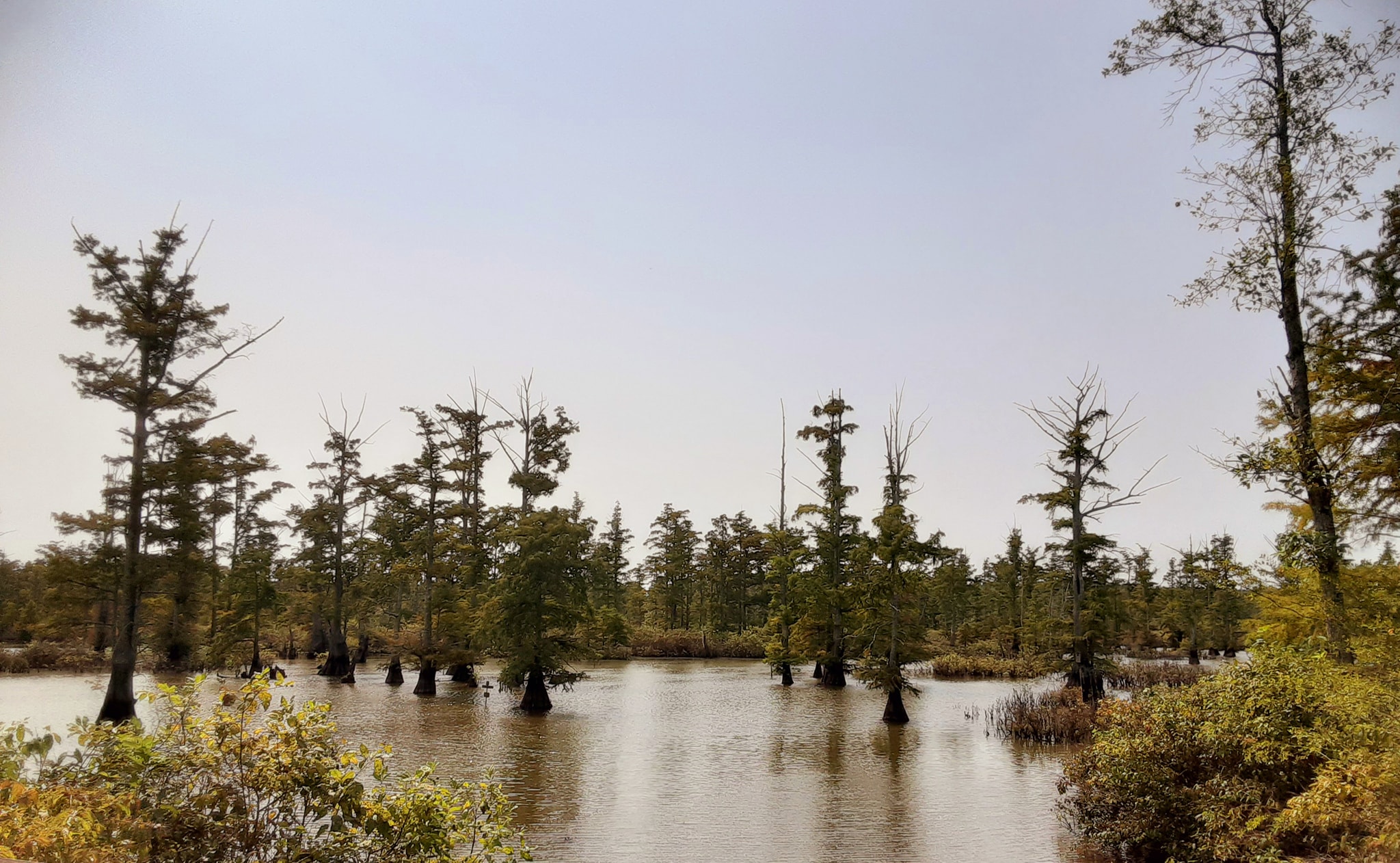
It’s the northernmost range of the Southern cypress and tupelo swamp in the Midwest. You’ll see a natural and true-to-the-area environment of the kind of swamp you see in the Bayous of Louisiana. Most of the Southern Illinois area was made up of these swamp-like environments before settlers came into the area and logged.
You’ll see amazing wildlife, plants, and flora throughout this area, as well. There are numerous birds, such as hawks, owls, herons, and egrets. Many different critters depend on the swamp, including various fish, snakes, beavers, otters, and salamanders. There are numerous plants and flowers, including giant cane, orchids, and rare flora.
Native Americans used this land for living, hunting, trading, and agriculture long before European settlers arrived. By the time settlers did arrive, timber harvesting was in full swing by the early 1800s. By the 1970s, concerned citizens banded together. They were able to make the area into preserves and natural land that can be enjoyed by all of the public, which led to what we now know the area to be, Cache River State Natural Area.
The forest and swamp within this area are covered in both hardwood and swamp trees. You can enjoy oak, hickory, and sweet gum in the forest and cypress and tupelo in the swamps. The Lower Cache River also hosts the state-champion bald cypress tree, which is said to be over 850 years old with 209 knees that you can see from the boardwalk trail or even paddling right up to on the river trail.
This area truly has something for everyone who wants to visit it, and it’s free of charge.
Lower Cache River Trail Descriptions
The swamp trail can be accessed on the left-hand side of the parking area as you pull into it. It is mainly a dirt trail that leads to a swampy area. In the summer, it might be grown up and hard to access at times.
The accessible boardwalk trail is to the right of the parking area as you pull in. It is made up of a concrete surface that can be used by wheelchairs. While the boardwalk isn’t accessible, those who can’t reach it should still get a nice view of the swamp.
The river trail can be accessed using the boat ramp. There is a dock beside the ramp to make it easier to board on and off your boat, canoe, or kayak. There is some signage along the swamp showing you where to paddle the 3 to 6-mile river route.
All of these trails are very easy to use and follow.
Directions to the Lower Cache River
Getting to the Lower Cache River area is very simple and easy.
The GPS Coordinates of the parking area is 37°17’52.9″N 89°03’10.4″W
To reach this area, you can create a route using this Google Maps Link.
The parking area has enough spaces for several cars and trucks with trailers.
Recommended Gear and Clothing
The following clothing and gear are recommended when visiting the Lower Cache River Access area:
Wear comfortable hiking and outdoor durable or athletic clothing that breathes and doesn’t hold in moisture.
Wear comfortable hiking boots or shoes that properly fit and are broken in.
Bring more water and snacks than you’ll need, and make sure you stay hydrated and fueled.
Bring plenty of bug spray (swamp areas tend to have more biting bugs than other areas) and sunblock if you plan to do the river trail. It’s ideal to use permethrin on your clothing and gear to help reduce ticks.
Bring your smartphone for pictures and videos or a camera. Cell phone signals may not always work when you’re using this area.
Trekking poles may be helpful to those who have balance problems.
Bring extra layers during the colder months and rain gear for when it is wet. Since the area is next to the river, use caution during flooding conditions.
Safety Tips and Trail Etiquette
Please consider these safety and trail etiquette tips when visiting the Lower Cache River area:
Weather Considerations: During heavy rain or flooding conditions, this area could be under water. During wintry precipitation, the roads and parking lot in this area may be untreated. Always make sure you get a weather report and plan accordingly.
Wildlife Awareness: Venomous snakes (copperhead and cottonmouth) occur in this area. Please avoid handling, collecting, or harming snakes to prevent a bite. Biting flies, ticks, and mosquitoes also occur in this area.
Leave No Trace: Please stay on the designated trail. This area is for day use only, and campfires are not allowed on the trail. Pack out what you pack in, and please Leave No Trace while visiting the Lower Cache River area.
Cell Service: Cell phone service may not work in this area. Please tell someone where you’re going before you visit, and try not to hike alone.
Remember to share the trail and recreate responsibly.
Other Stuff To Do Nearby
There are other hiking trails in this area to check out, including Limekiln Springs in Cypress Creek National Wildlife Refuge. You can also visit the many trails of the Cache River State Natural Area. A 45-mile bike trail starts in nearby Karnak,
There is camping and an Airbnb available in the nearby Village of Karnak.
There are restaurants, gas stations, and shopping opportunities available in Karnak and Ullin.
Ullin hosts its annual Cache River Days each year with yard sales, guided adventures, booths, and more.
Final Thoughts About the Lower Cache River
The Lower Cache River area is a beautiful place to visit, with many opportunities, whether you’re hiking, paddling, picnicking, or nature/wildlife viewing. If you follow the tips and directions in the guide above, you should have a good experience while visiting.
If you would like to support me in creating this free guide, you can do so by leaving me a one-time donation or by becoming a monthly supporter on my Patreon page.
Join my free online community dedicated to hiking and backpacking to discuss related topics with other members.
Check out my free monthly newsletter for more hiking tips, resources, and upcoming local events around the Shawnee National Forest and Southern Illinois State Parks.
And until next time, I’ll see you on the trail.
Check out the trail gallery!
Enjoy these photos taken around this area!
Lower Cache River Access
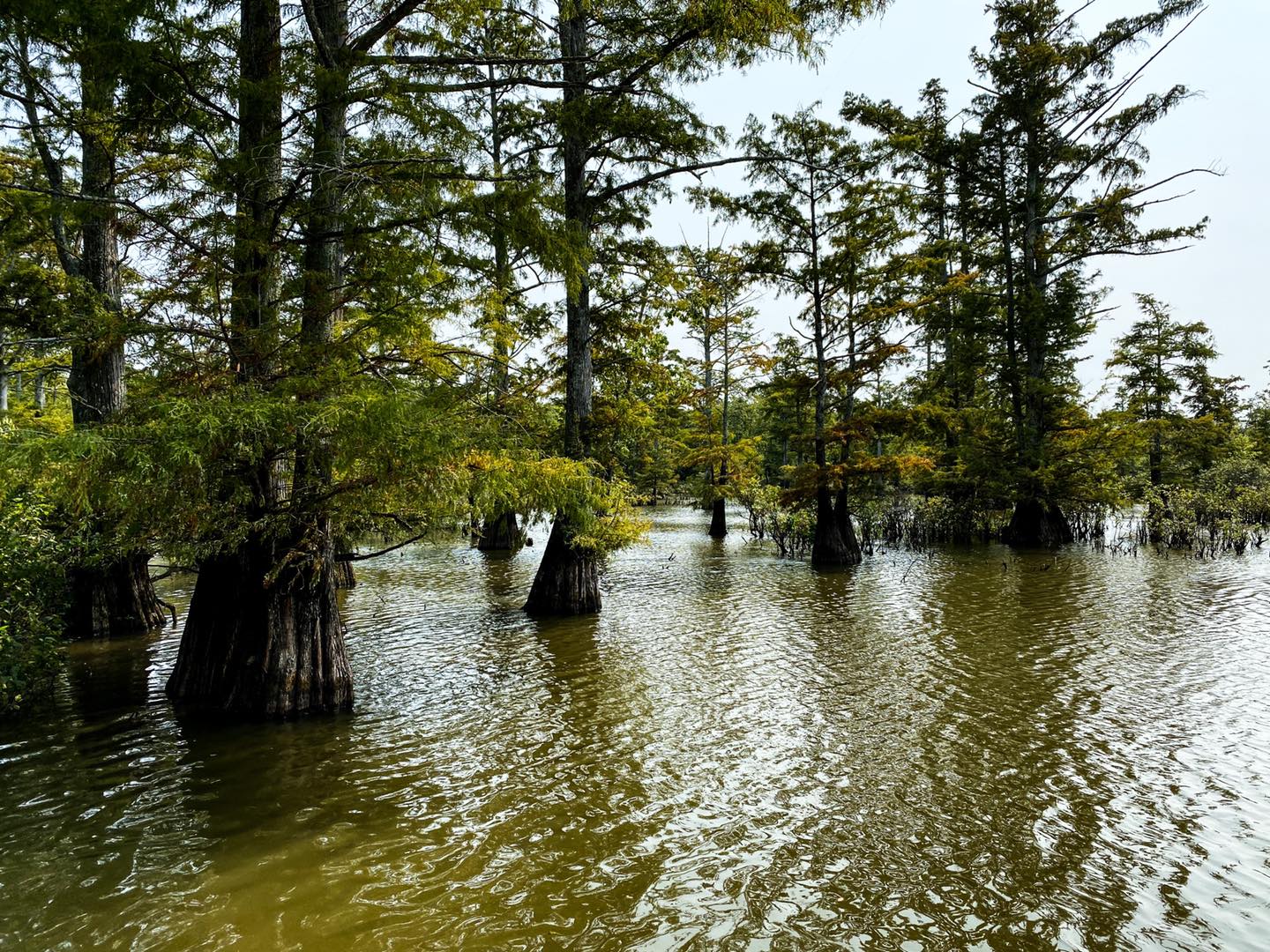
Lower Cache River Cypress Trees
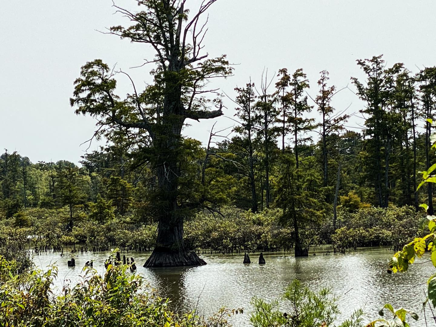
Illinois State Champion Bald Cypress Tree
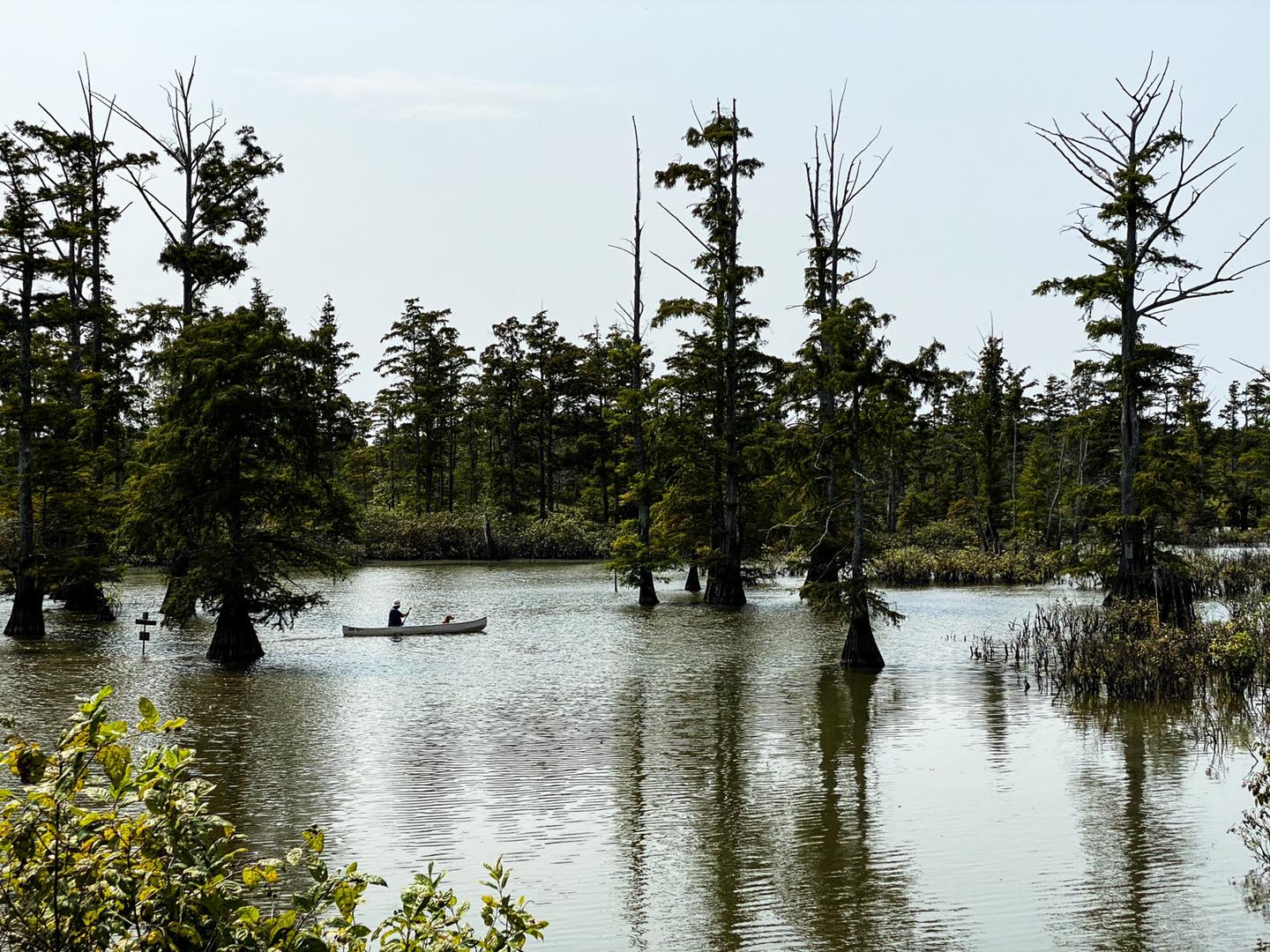
Lower Cache River Canoe Trail
Please Support Hiking with Shawn
Alrighty folks, I hope you have enjoyed this content. I provide it for free and it takes a while to create. If you would be so kind enough to support my efforts, you can do so by sharing this post with others, especially on social media. Be sure to subscribe to my YouTube Channel to see my latest videos, shorts and live streams. Follow me on Facebook, Instagram, Twitter and TikTok for unique content that you will only find on those pages. You might also join my Southern Illinois Hiking & Outdoor Resources Group on Facebook, too!
You can also support me by becoming a Patreon Supporter for as little as $3/month and you can cancel anytime (no contracts or catches). Patreons get access to extra features, exclusive articles, sticker packs, gifts and more. Consider buying official Hiking with Shawn Merchandise as another way to support me. I spend a lot of money on Hiking with Shawn and because of extremely high public land permit fees, I make very little money in return so everything helps.
Thanks again for checking out another one of my articles and until next time, I’ll see you on the trail!

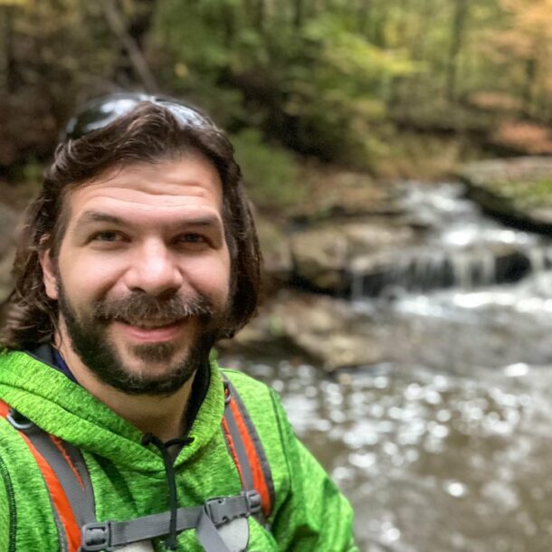
Shawn Gossman
Founder, Hiking with Shawn
Howdy folks! My name is Shawn Gossman and I founded Hiking with Shawn. I’m an avid hiker, cyclist and outdoorsman here in the Shawnee National Forest. I was born and raised in Southern Illinois and never want to leave. Click here to learn more about Shawn Gossman