Hiking with Shawn’s
Guide to the Wilderness Areas
of the
Shawnee National Forest:
Bay Creek Wilderness
Bay Creek Wilderness is a Designated Wilderness Area within the Shawnee National Forest. Consisting of 2,866-acres, Bay Creek Wilderness is located in rural Pope County, Illinois. Bay Creek Wilderness also borders the Burden Falls Wilderness Area. Bay Creek Wilderness is managed by the US Forest Service for the Shawnee National Forest. Bay Creek Wilderness is a part of the Hidden Springs Ranger District.
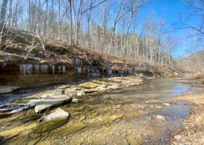
Likely acquired in the 1930s through the Shawnee Purchase Unit, Bay Creek Wilderness is 1 of 7 Wilderness Areas in the Shawnee National Forest. The area is made up of second-growth forest. Bay Creek Wilderness was once farmland and settlement from earlier pioneers. The area consists of bluffs, scenic creeks and rolling hills.
HOW TO GET TO bay creek WILDERNESS AREA
Check out this map to see the area of Bay Creek Wilderness.
There is no real access to this particular Wilderness aside from a few points. You can access trails into Bay Creek Wilderness by parking on the side of the road about an eighth of a mile southwest on Ozark Road past Mc Cormick/Burden Falls Road. You should see the ‘Bay Creek Wilderness’ sign at the start of the trail. One could also access the wilderness area by parking at the Burden Falls Trailhead on Mc Cormick/Burden Falls Road and crossing the road to get into the wilderness area.
TRAILS WITHIN THE bay creek WILDERNESS AREA
There are a few designated trails in the this Wilderness. These trails are primarily used by equestrian users, but hikers are welcome. The best way to access these trails is with a paper map which you can purchase online at Friends of the Shawnee National Forest or by downloading an app onto your smart phone with these maps in them. We personally recommend (not sponsored) OnXHunt or Gaia GPS for your smart phone.
By starting on the trail on Ozark Road, you can make a 7 to 8-mile loop hike (going right or left) by following Trail-499M (to the right) onto the Dog Leg and then to North Bay Creek Trail and back to where you started. This itinerary was created using the Gaia GPS app linked above.
Do note that these trails are not often used and may be grown up during the warmer months.
WHAT bay creek WILDERNESS HAS TO OFFER
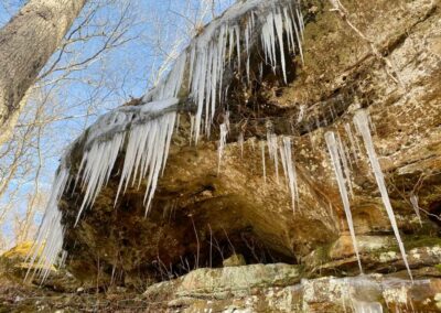
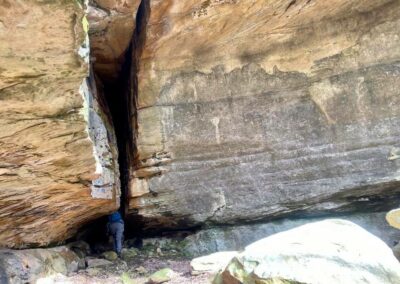
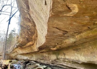
The main trails within this Wilderness are primarily used by horse and mule riders but hiking and backpacking is welcome. There are some areas of bluffs within this wilderness but not a lot of them. Bay Creek, a wild and scenic river candidate, runs through this wilderness area. This wilderness often has many scenic sights along it including many portions of it within this wilderness area. Most of the more interesting sights will be located in the middle portion of the 499M loop mentioned above – please use caution when going off trail.
As this Wilderness was once the property of farmers and early settlers, the area has signs of previous settlement within it. This may include wells, foundations, cemeteries, abandoned cars, old litter and orchards. We recommend using the ‘Historic Topo 1930’ map layer for Gaia GPS to see where some of the previous homesites may have been.
Wilderness users commonly perform the following activities in the Wilderness: Hiking and backpacking (difficult), horseback riding (difficult), camping (dispersed, no reservation or fee), nature viewing, hunting (big game, small game) and scenic driving (roads around the wilderness). What will you do in the Wilderness?
SPECIAL CONSIDERATIONS FOR bay creek WILDERNESS AREA
This wilderness follows the same guides listed on our Main Wilderness Guide article.
There are no restrooms or trash services at trailhead for this wilderness. Please practice Leave No Trace ethics and pack out what you pack in.
Venomous snakes occur within this and nearby areas including the copperhead snake. Avoid a negative experience with a venomous snake by watching where you step, staying on the trail, giving snakes plenty of room and never attempting to handle or harm a snake.
This area consists of rugged and steep terrain, rolling hills and sometimes very muddy conditions. Accessing this area can be a challenge and is often considered a difficult level of recreation. Please plan accordingly before venturing into this area.
Cell phone signal may not be available in many areas of the Wilderness.
EMERGENCY INFORMATION FOR bay creek WILDERNESS AREA
The nearest hospital from Bay Creek Wilderness is located in the City of Harrisburg, Harrisburg Medical Center which is about 20-miles from the Bay Creek Trailhead on Ozark Road.
For emergencies – dial 911 and follow the instructions of the 911 operator.
WHAT’S CLOSE TO bay creek WILDERNESS AREA?
Eddyville is the closest community to Bay Creek Wilderness. Eddyville is a very small community with very few points of interest. Hangout Campground is in Eddyville and could provide camping opportunities for multiple types of camping users including bikepackers, backpackers, equine, RV/camper and tent camping. Shotgun Eddy’s is a really good bar and grill styled establishment with great breakfast, lunch and dinner as well as adult beverages and a very large outdoor seating arrangement. Equestrians can also camp at Hayes Canyon Campground which is an official permitted equine campground outfitter very close to Bay Creek Wilderness. Unfortunately, the one store/gas station in Eddyville, Shawnee Mart, has since closed down. The City of Harrisburg north of Eddyville is the next best community with multiple gas, food, grocery and other points of interests.
Burden Falls Wilderness Borders Bay Creek Wilderness as well. Lusk Creek Wilderness is a few miles away from Bay Creek Wilderness, too. Other Shawnee National Forest areas of interest close to Bay Creek Wilderness include Bell Smith Springs, Jackson Falls, Sand Cave and Millstone Lake. There are numerous equestrian trails, hiking, cycling, hunting, fishing and kayak/canoe opportunities close to these areas.
VIDEOS OF THIS WILDERNESS AREA
Check out the following video footage of this particular wilderness area.
Thank you for taking the time to read this Wilderness Area Guide. This and the other 6 guides took a while to create and are offered for free of charge. Please consider supporting my efforts of making these guides by sharing them with others, especially on social media. You can also support my efforts by following me on YouTube, Facebook, Instagram, Twitter and the Official Website for Hiking with Shawn. Consider becoming a Patreon Member or purchasing some official merch from the Hiking with Shawn Online Shop. Thanks again for checking out this guide and until next time, I’ll see you on the trail!
Shawn J. Gossman
Host
Shawn is the founder and host of the YouTube Channel, Hiking with Shawn as well as Hiking with Shawn LLC. Shawn hikes, backpacks and visits various forested areas in the Shawnee National Forest, local state parks and other areas promoting outdoor recreational activities to obtain video to show to locals and non-locals alike. Please support Shawn’s efforts by sharing this post and leaving a comment below.

