Bork Falls to Cedar Bluff Hiking Guide
Have you ever hiked Bork Falls to Cedar Bluff (or reverse)?
If you haven’t yet, and you’re looking for a nice long out-and-back hike, this would be an excellent hiking trip for you to enjoy.
This hike is around 10 miles out and back (from start to end and back to start).
It’ll be around 1,200’ to 1,400’ of elevation gain, but the hills are not too strenuous.
There is a lot to see on this trail. It’s perfect for adventurous families, trail runners, or hikers looking for a long adventurous trail.
To help you out, I’ve created this free Bork Falls to Cedar Bluff hiking guide.
Directions to the Bork Falls to Cedar Bluff Hiking Trail
From Goreville, the quickest way to get to Bork Falls Trailhead is to take Highway-37 to Goreville Road/Main Street and head west.
Drive about 2.7 miles until you reach Regent Lane to your left. Turn onto Regent Lane. If you make it to the I-57 ramps, you’ve gone too far. Turn around, and the road will be on your right after you pass the equestrian sale barn.
WARNING: Regent Lane is a gravel road. Because the road goes downhill and curves, it’s often a victim of severe erosion. There will likely be large potholes and areas on the sides that you don’t want to drive into accidentally. Drive carefully and slowly. After large rainfall events, the road may be impassible for some vehicles. If you have a vehicle that is low to the ground, it isn’t recommended to drive this route. There have been times when I almost turned around due to my 4×4 truck almost having issues getting around the erosion.
CAUTION: The creek that feeds the Bork Falls waterfalls runs over Regent Lane. You must cross it to access the parking and the trail itself. The portion of the road the creek runs over is rock. There are dips and potholes in it. Most vehicles can get across. However, during exceptionally heavy rainfall, the crossing could be hazardous. Large amounts of fast-moving water can carry a vehicle off its driving position. Use caution and always put safety first.
Alternative Directions to Trailhead
There is an alternative way to get to the parking lot for this Bork Falls to Cedar Bluff Hiking trip. It’s a little longer but less hazardous with dealing with the road erosion and potential dangers of crossing over a rapidly moving creek.
From Goreville, take Highway-37 south to West Side Street.
Shortly after, drive to the end of the road and turn right onto South Fly Ave.
Shortly after, drive to and turn left on W Ferne Clyffe Street.
Drive 1.2 miles and turn left on Happy Hollow Road.
Drive 4.3 miles and turn right on Cedar Grove Road.
Drive 3 miles, and your parking area will be on your right. It’s also part of the River to River Trail.
There is room for a few cars to park.
This Google Maps Link is where the trailhead is on Regent Lane. Alternatively, you could start at Cedar Bluff Trailhead and do the hike in reverse. There may be limited parking at Cedar Bluff during church services, but another small parking area is up the road (Happy Hollow Road) from the church.
Information About the Bork Falls to Cedar Bluff Hiking Trail
To complete the Bork Falls to Cedar Bluff Hiking Trail from start to finish and back to start, follow these steps:
- Take the R2R Trail south into the woods from where you parked.
- Once you reach the gas line right-of-way, turn right, and continue until you get into the Bobcat Loop Trail.
- Take the Bobcat Loop Trail until you reach the Cedar Bluff Trail on your right, take the Cedar Bluff Trail by going right.
- Go to the end of the Cedar Bluff Trail, which is the end of the trail.
- Walk back up the Cedar Bluff Trail until you get to the Bobcat Loop once again, but this time, turn right to finish the loop.
- Pass the Buck Creek Trail by staying on the Bobcat Loop trail or staying left.
- Once you reach the River to River Trail, turn left and return to where you parked.
There is a lot to see along this trail. Keeping the above steps fresh in your mind, I’ll explain what you’ll see along each segment.
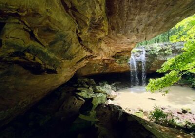
From the start of your hike, if it’s wet, you’ll enjoy Bork Falls at its finest. It’s an amazing waterfall that you should try to see at least once when it is running. The water has made a large pool and a nice cave shelter behind it. You can carefully go behind the waterfall for a cool experience, especially when it’s hot.
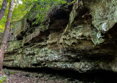
Back up on the River to River Trail, there will be amazing bluffs to view along the first part of the hike. It gets good from the start on the Bork Falls to Cedar Bluff Hiking Trail.
After passing through the gas line clearing, you’ll enjoy a simple hike in the woods with scenic creeks. You’ll have to cross some of these creeks. If there has been a lot of rain, you might get wet in the process. The Bobcat Loop trail has interesting things to see on both sides. There are old farming implements and signs of past agricultural use. There are beautiful hillsides covered in ferns.
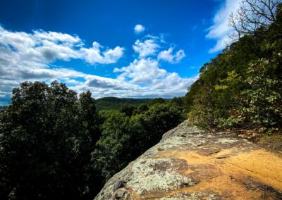
The Cedar Bluff Trail is mostly an uphill climb, but a reward is at the top. You’ll enjoy the amazing overlooks that the top portion has to offer. You’ll need to take a side trail to get to the overlook, but it’s not long and worth seeing. You can even see Draper’s Bluff from the overlook. Draper’s Bluff was a popular rock climbing bluff with a Native American Stonefort on it. However, sadly, it’s privately owned and closed to the public.
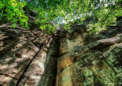
After you enjoy the overlook, you’ll hike down to the bottom of the Bluff and see where people climb. Depending on the time of the year, you might encounter some climbers. They’re all usually very friendly people to meet.
Then you get to hike back and enjoy it all over again. If you have the time, I suggest exploring more on the way back. Check out the bluffs, walk the creeks, and enjoy the area because it’s a nice area.
This area is for day use only. There are no camping activities allowed in this area. The area is managed as a remote tract of Ferne Clyffe State Park. The trails may be used by hikers and horseback riders only. Motorized vehicles and bicycles are not permitted to use the trail.
Suggested Hiking Seasons and Gear for this Hiking Trip
The best time to hike Bork Falls to Cedar Bluff Hiking Trail would be late winter into early spring. During this season, there are fewer ticks and biting insects, less of a chance of seeing snakes if you don’t want to see them, and the trail is easier to follow.
On snakes, venomous copperheads do occur in this area. Poison ivy and ticks may also be a problem for you during warmer seasons. Avoid most hazards by staying on the trail and watching where you step.
We hiked it during September. It was hot and humid, and some parts of the trail were grown up but still easy to follow. The worst of the grown-up portions were in the gas line clearings. Warm weather use of the trail is nice because getting in the creeks and letting, and waterfall hit you makes for a nice summer cool-off activity.
Snow-covered hiking could be interesting and unique, but getting to the trail will likely be difficult when wintry precipitation is on the ground.
WARNING: During firearms hunting season, hunters will be in this area. Please respect hunters and consider enjoying a hike in a non-hunting area during hunting season. If you do venture there instead, make sure you wear blaze orange.
Bring a backpack with plenty of water and snacks. You might want to bring a water filter, just in case. Bring the basic hiking gear you would on every hike, such as a first aid kit, flashlight, compass, and other supplies.
Bring some water-crossing shoes. We typically use neoprene socks to cross creeks. It keeps our feet dry, and they’re lighter to carry than shoes. The socks provide some padding which helps when stepping on colder rocks.
The trails are wide and easy to follow. Hiking apparel-wise is up to you. In the summer when we went, I wore shorts and a t-shirt. There were some areas where I went through the undergrowth, but I did a “tick cleansing” after every hike. I get hot easily, so I wear shorts throughout the summer.
The most important thing to bring is water and plenty of it.
Other Hiking, Dining, Sightseeing, and Lodging in this Area
There is much to do and see around the Borks Falls to Cedar Bluff Hiking Trail.
For other nearby hiking, check out Ferne Clyffe State Park. One of my favorite trails there is Blackjack Oak. It has a lot to see for being only a little over a mile in length.
Tunnel Hill State Trail is close to this area. You could enjoy a walk to the tunnel or a bike ride along the trail. It’s also a favorite place among runners if you want to get some steps in.
There are a few lodging options in this area. The closest campgrounds are Hilltop Campground and Ferne Clyffe State Park Campground. Some Airbnb-type rentals include The Saltwater Pool House and Shawnee Trails Lodging and Suites. Cedar Rock Cabins is also close to the main state park and the village of Goreville.
For dining, I highly recommend Whiffle Boy’s Pizza in Goreville. We enjoy their cheese bread and pizza every time we visit the area. It’s a local chain, and it helps make southern Illinois unique.
Check out the little stores that downtown Goreville has to offer. I’m sure you’ll find something you enjoy from them.
Watch the videos for this trail!
Below is a recent video that we filmed while enjoying this area.
Please Support Hiking with Shawn
Alrighty folks, I hope you have enjoyed this content. I provide it for free and it takes a while to create. If you would be so kind enough to support my efforts, you can do so by sharing this post with others, especially on social media. Be sure to subscribe to my YouTube Channel to see my latest videos, shorts and live streams. Follow me on Facebook, Instagram, Twitter and TikTok for unique content that you will only find on those pages. You might also join my Southern Illinois Hiking & Outdoor Resources Group on Facebook, too!
You can also support me by becoming a Patreon Supporter for as little as $3/month and you can cancel anytime (no contracts or catches). Patreons get access to extra features, exclusive articles, sticker packs, gifts and more. Consider buying official Hiking with Shawn Merchandise as another way to support me. I spend a lot of money on Hiking with Shawn and because of extremely high public land permit fees, I make very little money in return so everything helps.
Thanks again for checking out another one of my articles and until next time, I’ll see you on the trail!
Shawn Gossman
Founder, Hiking with Shawn
Howdy folks! My name is Shawn Gossman and I founded Hiking with Shawn. I’m an avid hiker, cyclist and outdoorsman here in the Shawnee National Forest. I was born and raised in Southern Illinois and never want to leave. Click here to learn more about Shawn Gossman

