Hiking to the Bottom of Owl Bluff in Lusk Creek Wilderness
We recently hiked to the bottom of Owl Bluff in the Lusk Creek Wilderness of the Shawnee National Forest.
Even though it was during leaf-off, this wasn’t an easy hike. We had to hike a few miles of the trail and then cross Lusk Creek. The main hike was off-trail in a very steep and rugged area.
But hiking to the bottom of Owl Bluff was an adventure, and I’m glad we did it because we saw a lot.
In this article, I’ll share with you how we made this journey, which was about a 6.6-mile rugged loop.
Why Hike to the Bottom of Owl Bluff?
You can hike to the bottom of Owl Bluff for many reasons, but your main reason should be for the adventure of it all.
As I said above, this wasn’t an easy hike. It was very rugged, slippery (I feel hard), and steep. If you want something for exercise and strenuous fitness, this hike would be perfect for it.
The main things you’ll get to enjoy are the scenic creek scenes, bluffage, and natural shelters along your adventure.
The biggest reason we like to hike these off-trail areas is the exploration value. We want to see every possible publicly accessible inch of the Shawnee National Forest, and this helped us achieve that goal.
Who this Hike is For and Not For!
Hiking to the bottom of Owl Bluff is for true and experienced adventurers.
If you’re an experienced hiker, then this hike is for you. You’ll need experience hiking rugged and uneven terrain, as most of the off-trail portion was pretty rugged and steep. You’ll also need some navigational skills and be able to read your paper map or app map.
This hike is not for the inexperienced hiker.
If you have little to no hiking experience, you shouldn’t do this hike. If you have balance or mobility issues, then this hike would likely be dangerous for you. As I said, I fell hard enough that my knee was bruised for about a month, and I’m a very experienced hiker, so please do this hike at your own risk.
Directions to the Bottom of Owl Bluff
See this Google Maps Link for where to park for hiking to the bottom of Owl Bluff. You can also get to it at these GPS coordinates: 37°31’48.2″N 88°34’14.1″W. The roads to this trailhead are paved but typically untreated during wintry conditions. The trailhead offers vehicle parking, horse trailer parking, signage, and a vault restroom.
Take the River to River Trail across the street to the left of the Horse Campground if facing it with the trailhead behind you. Stay on the River to River Trail (right) once you get to the Wilderness Boundary signage. The River to River Trail blazes are blue and white diamonds with “i” in them when in non-wilderness, and they all wood colorless blazes when in wilderness areas.
At one point, you’ll go down some big stairs made from rocks and get to a trail junction. Stay on the River to River Trail (right) and it will take you down into a canyon. You’ll cross Little Bear Branch (small creek), and then shortly after, you’ll reach the Bowed Tree Crossing for Lusk Creek. There is an easier crossing if you take the trail to the right. You’ll want to do that anyway; otherwise, you won’t be able to edge the bluffs at Bowed Tree Crossing because they’re too close to the creek.
After you cross, head for the bluffs and follow them. It gets rugged in some spots, and you’ll reach challenging points where it’s sketchy and close to the creek. You just have to look around and see what your best option is. The shelter you want, the bottom of Owl Bluff, is located at 37°31’20.5″N 88°32’42.4″W.
There is a waterfall to the left of the shelter at the bottom of Owl Bluff. We went to the left of that waterfall and climbed up to the top to reach the trail that takes you to the top of Owl Bluff (River to River Trail). If you climb up and get to that, just go left on the trail, and it will switch back you down to where the Bowed Tree Crossing is, which can be tricky without a horse if it’s muddy.
What You Will See Hiking to the Bottom of Owl Bluff
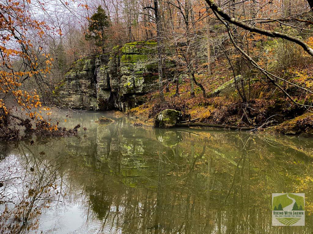
The main thing you will see when visiting the bottom of Owl Bluff is a lot of bluffage, which is my favorite kind of adventure to embark on.
There are also many great views of the very scenic Lusk Creek. At certain points, the creek snakes and flows through all sorts of natural fords and cascades. If there is a lot of water rushing through the creek, while it makes it harder to cross, it’s a really beautiful sight.
There are a few very large natural shelters along this hike, including the big one at the bottom of Owl Bluff.
When we went, we had the pleasure of spotting a very large and healthy coyote eating what was left of a deer. I got a few photos of the coyote, and we watched it eat for about 5 minutes before it saw us and quickly got away. Most of the time, coyotes will flee if they see you, but if not, take your pack off, hold it over you, look big, yell, and scream at it, and it will likely leave.
Safety Information for the Bottom of Owl Bluff
First and foremost, there are no trails along the bluff line to the bottom of Owl Bluff and there is no All Trails page for it.
This area is not for beginners. It is really steep in many places, rugged and rocky, and has a majority of very uneven terrain. We had to take our shoes off to cross Lusk Creek, and it was about as deep as up to my knees, which is a few feet. The water was also moving rapidly.
There is no cell phone signal in this area, and it would take a lot of time and effort for emergency crews to get to you in the event of a rescue operation.
There are some hazards in terms of animals, bugs, and plants. As I stated before, coyotes are in this area, and so are copperhead and timber rattlesnakes. Feral pigs have been reported in this area. Mosquitoes, ticks, and biting bugs occur here. Poison ivy and stinging nettles also occur here. To avoid most of these hazards, I suggest visiting during the winter as summer will give you an extremely grown-up and hard-to-navigate area.
Gear and Clothing Recommendations
The most important things to bring with you on your journey to the bottom of Owl Bluff are plenty of drinking water and snacks.
Consider bringing some survival items just in case you need them, such as a folding saw, weather-proof matches, a poncho for shelter, and a shock blanket. You should also carry a first aid kit with you in case you fall like I did. Bring some extra layers and consider a water filter as well.
You should bring some gear with you in case you need help, such as a personal locator beacon, headlamp, and whistle.
Bring comfortable hiking clothing rated for outdoor use and the weather. Wear hiking boots that fit and are worn in from previous use, and wear comfortable wool socks. Some extra layers and a rain kit might also be a good idea.
Things To Do in the Area
There are many great things to do when in the area near the bottom of Owl Bluff and Lusk Creek Wilderness in general.
Check out the Bear Branch Loop, which is the loop trail on the side of the road where the trailhead is where you parked. You can also enjoy many different loops and trail systems throughout the Lusk Creek Wilderness. These trails are for hikers and horseback riders only.
If you need a good place to eat breakfast, lunch, or dinner – I recommend Shotgun Eddy’s in nearby Eddyville. It’s the best food around, and the staff are the friendliest people you’ll ever meet. Be sure to take a selfie with Sasquatch while you’re there!
Final Thoughts on This Trip
Visiting the bottom of Owl Bluff was definitely a fun adventure. Still, it’s not an adventure for beginners or those with little to no experience in navigating off-trail hikes. Please use extreme caution if you go, and do so at your own risk. This article is only meant to educate and does not suggest you hike this trip.
If you’ve been to the bottom of Owl Bluff, comment below and tell me what you thought of the hike and the area!
If you enjoyed this free article, you could give me a one-time donation for writing it or even become a monthly supporter of my Patreon Page.
Join my free Hiking and Backpacking forum today to discuss hiking and backpacking from around the world!
To get more hiking tips, resources, and local events in and around the Shawnee National Forest sent right to your inbox, be sure to subscribe to my free monthly newsletter today.
And until next time, I’ll see you on the trail.
Watch the videos for this trail!
Below is a recent video that we filmed while enjoying this area.
Check out the trail gallery!
Enjoy these photos taken around this area!
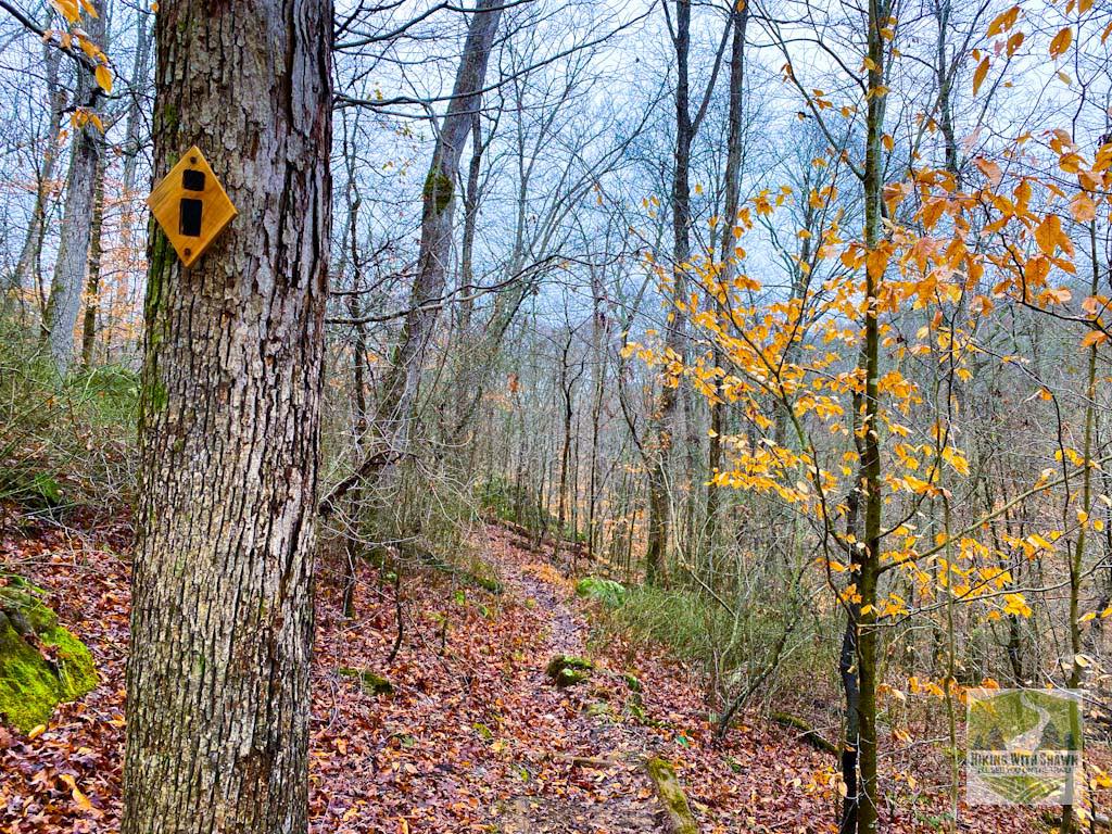
River to River Trail
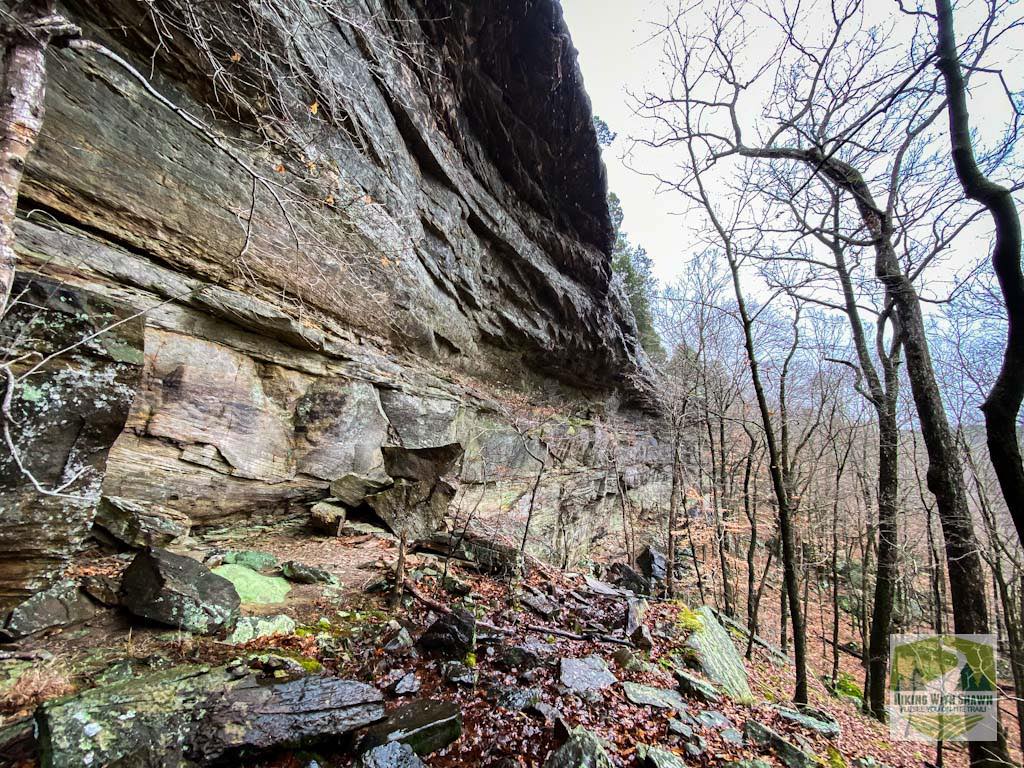
Bottom of Owl Bluff
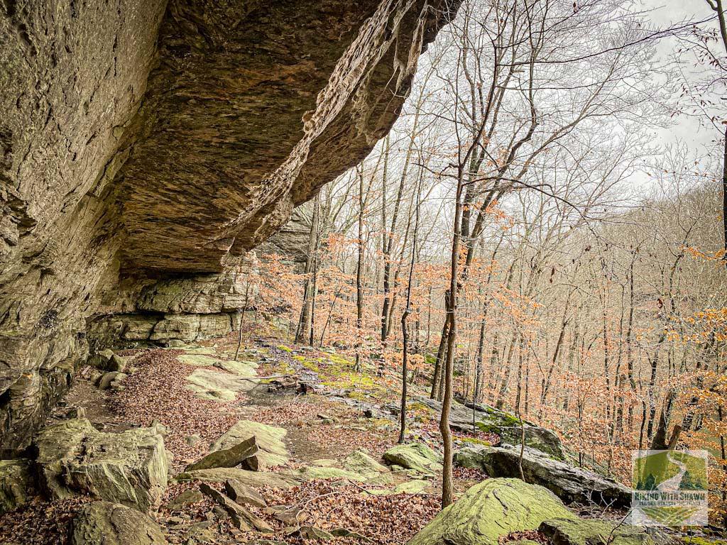
A Natural Shelter
Crossing Lusk Creek
Please Support Hiking with Shawn
Alrighty folks, I hope you have enjoyed this content. I provide it for free and it takes a while to create. If you would be so kind enough to support my efforts, you can do so by sharing this post with others, especially on social media. Be sure to subscribe to my YouTube Channel to see my latest videos, shorts and live streams. Follow me on Facebook, Instagram, Twitter and TikTok for unique content that you will only find on those pages. You might also join my Southern Illinois Hiking & Outdoor Resources Group on Facebook, too!
You can also support me by becoming a Patreon Supporter for as little as $3/month and you can cancel anytime (no contracts or catches). Patreons get access to extra features, exclusive articles, sticker packs, gifts and more. Consider buying official Hiking with Shawn Merchandise as another way to support me. I spend a lot of money on Hiking with Shawn and because of extremely high public land permit fees, I make very little money in return so everything helps.
Thanks again for checking out another one of my articles and until next time, I’ll see you on the trail!

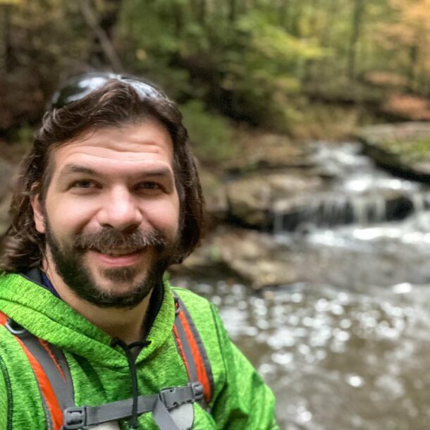
Shawn Gossman
Founder, Hiking with Shawn
Howdy folks! My name is Shawn Gossman and I founded Hiking with Shawn. I’m an avid hiker, cyclist and outdoorsman here in the Shawnee National Forest. I was born and raised in Southern Illinois and never want to leave. Click here to learn more about Shawn Gossman