Hiking with Shawn’s
Trail Guide Series:
Bulge Hole
Ecological Area
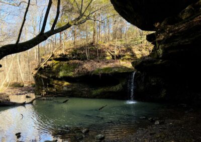
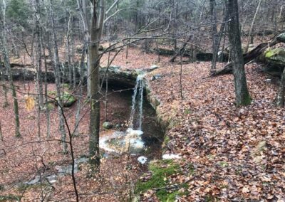
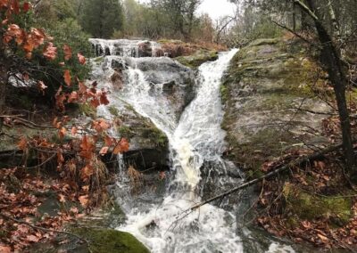
Bulge Hole Ecological Area or Bulge Hole EA for short is a wonderful hidden gem of the Shawnee National Forest. The ecological aspects of Bulge Hole deals with precious plants and flora that could be growing within the protected area. The main attraction of Bulge Hole EA though isn’t necessarily the plants and flora, to most, it is the waterfalls and the amount of the waterfalls at that. The first time I visited Bulge Hole EA, I found upwards of 15 to 20 actively flowing waterfalls of all different shapes and sizes. When it comes to chasing waterfalls in the Shawnee National Forest, I would have to say that Bulge Hole EA is probably my favorite place to chase them. It is such a special place!
And with that, it is important to take note that Bulge Hole EA is not a maintained area of the Shawnee National Forest. There are no official designated trails aside from the Forest Service Road that starts at the county road and that road might not even be designated, either. Bulge Hole EA can be hazardous to your safety and well-being. Areas around waterfalls, especially on the tops of them are often slick and dangerous. Serious injuries to even death can easily occur from those who fall in these areas. Cell phone coverage is often limited and even unavailable in this area most of the time. Rescue efforts may be a significant challenge. If you fall, you might be there for several hours until help can get you to safety. Please use extreme caution when visiting areas like this and always put safety first.
As an Ecological Area, sensitive flora and plants may be among your travels. Please tread lightly and make sure you clean your footwear and gear before visiting in an attempt to help preserve the precious botanical elements within. Watch where you step and always Leave No Trace. Pack out what you pack in as there are no trash services located at this area.
Bulge Hole Ecological Area is managed by the US Forest Service – Shawnee National Forest. This guide is not an official document of the US Forest Service and it is intended for educational purposes only. Please use the following information “as is” and at your risk.
Area Directions and Trail Information
See this map for points of interest around the area of Bulge Hole EA.
If traveling from Vienna, at the HWY-146 and HWY-45 intersection, take HWY-45 north for about 1.6-miles until you reach Holly Road to your left. Take this left (it is right after the water tower) and drive 360-feet until you reach the T intersection. Turn right onto Dutchman Lake Road and drive north for about 3.7-miles until you reach Bowman Bottoms Road (gravel). Turn right onto Bowman Bottoms Road (you will drive under Interstate-24) and drive for roughly 1.2-miles until you have a field/farm on your right and forest on your left. This where the trail starts. Park on the side of the road but make sure you leave plenty of room for people to be able to pass as people live along that road.
During the winter, this road will likely not be treated like other roads so please use caution. Bowman Bottoms Road is gravel and some potholes are present so please drive carefully and slowly. There are no signs at this trailhead. You want to look for the Forest Service Road on your left (west). The forest will remain visible on the west side of the road and the east side it will stop at a field/horse/farm area. There should be Forest Service boundary signs present. Most people park on the side of the road on the west side across from the field (private property).
Take the Forest Service Road to your west by foot (not suitable or legal for motorized vehicles) for about 0.8-miles, passing the power line right-of-way until you reach the Bulge Hole Ecological Area official Forest Service Sign. The sign will be on your right on top of a hill next to the trail. Right after the rocky creek area by the right will be a faint trail to your right (north). You will take it to get to the bottom of the ecological area in order to access the base of the waterfalls.
Due to the lack of official trails and any sort of signage whatsoever, it is strongly advised that you use a topo map of the area or an application/GPS service. I use OnXHunt (not sponsored) which is handy for reading topo maps and seeing property boundaries. There is private property at the far north and eastern sides of the area and owner is firm about not wanting people to trespass. Do not trespass – recreate responsibly! Without the ability to see topo maps in this area, navigation the area will be a challenge.
The following GPS Coordinates are areas with the most impressive features:
- Large Cave Shelter & Waterfall: 37.50499, -88.89318
- Western Waterfall: 37.50842, -88.89619
- Eastern Waterfall: 37.50768, -88.89258
- Northern Waterfall: 37.50955, -88.89325
(Note: The above coordinates may be off a little, but those general areas are where the features can be found.)
Check out this link to one of my Strava recordings (GPS tract available) of the Bulge Hole EA area. We hiked almost 5-miles that day with about 500’ of elevation. It is recommended that you start early in the day in order to have as much daylight as possible.
Area Points of Interest
There are numerous points of interest along this area. When walking from the gravel road where you parked on the forest service road, you can make a right (north) at the power line right-of-way and within 0.8 of a mile, there is a very nice multiple waterfall cascade in that right-of-way which feeds larger waterfalls in the forested area to the west of that area. If you do go this way, do note that the area is usually full of briers during warmer months and can be very challenging to navigate.
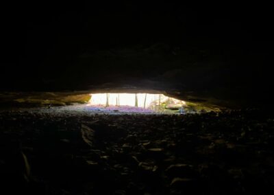
The ‘Large Cave Shelter’ coordinates listed above will take you to an area with a very deep and long natural cave shelter. Sometimes the shelter is full of fog and provides an almost horror-movie like element to it. On one side of the shelter is a very nice flowing waterfall with a large deep pool. This pool might be worth wading into by the most curious of people.
Following the creek up from the large cave shelter after the larger waterfall, you can quickly access other waterfalls to the right-side of the creek (you will have to cross the creek) which include the eastern and northern waterfalls listed above. The western waterfall can be accessed by following the creek up until another creek branches off and goes to the left of the main creek. Follow the creek to its end (less than a quarter of a mile) to find the western waterfall.
Pending on how wet the area is, finding more smaller waterfalls will be likely. The trick is following the creek and the bluff lines in order to see the waterfalls. Some of the waterfalls are extremely challenging to nearly impossible to access without putting yourself in harm’s way. Please use caution and common sense when chasing these and any waterfalls you find.
If you continue to follow the eastern bluff line to your north, you’ll find other features as well including interesting rock formations, banding in bluffs, other smaller natural shelters and even a natural arch. Eventually you will se barbed wire to your right (east) and barbed wire across the while ravine and creek to your north. These areas indicate the private property boundaries. Please respect private property by not trespassing.
Word of advice: Waterfalls in southern Illinois and the Shawnee National Forest are extremely rainfall dependent. This means that they need a few days of rain in order to have a decent flow. If you haven’t had much rain – don’t expect an active waterfall. If we have had a lot of rain – expect there to be plentiful amounts of waterfalls. When I seen the area at its best, the region was having a lot of flooding and flash flooding so there was a lot of water. The area is still beautiful without active waterfalls. I have visited the area in the spring when wildflowers are blooming, in the summer when everything was grown up, in the fall when the colors were amazing and, in the winter, when the snow-covered hills displayed a frozen waterfall bliss. Bulge Hole EA is truly an amazing gem of the Shawnee National Forest.
Area Safety and Important Information
One of the most common causes of serious injury and death in the Shawnee National Forest are falls. In many cases, most of the falls are at or around the tops of waterfalls. The rocky bluff is slick even when dry from vegetation, soil and dust that might be present. When rocky areas are wet, in many cases, the surface can be as slick as ice. Slipping on the tops of waterfalls and falling is so easy that it is a common reason for injury and fatality at least one to three or more times each year. Please don’t become a statistic while visiting the Shawnee National Forest. Leave with good memories, not bad injuries. Please use extreme caution around wet areas especially with fall hazards. It doesn’t take much to fall and it can happen to anyone, including YOU!
Bulge Hole EA is best described as very rugged and difficult to navigate all seasons of the year due to a lack of maintained trails, fall hazards, rolling hills and creek crossings. Sturdy hiking footwear will be required to access this area. This is not a flip flops area at all. You might have to cross creeks where the water will be a foot or more deep pending how wet it is. Hiking in this area will not be an easy task and is considered risky.
Venomous copperhead snakes have been observed in this area by many visitors. We personally observed one under a shelter by one of the eastern waterfalls. The snake blended into the rocks very well. Note that it is illegal to handle, collect, harass, injure or kill any snake on National Forest land.
Please tell someone where you will be going before you go and try not to hike alone.
Pack plenty of food and water with you to stay hydrated and fueled. The rugged conditions and rolling hills will require this.
This is an ecological area meaning that while foot traffic is welcome – traffic from motor vehicles, horses and mules and bicycles is not welcome, in fact, it is against the regulations. Camping and creating fires in this area is prohibited. Collecting or harvesting wildlife and sensitive flora/plants is prohibited.
Treat this area like a sensitive flower garden and always tread lightly and watch where you step. If we destroy the elements that the area protects, we risk losing the area altogether. Bulge Hole EA would be a terrible loss of the Shawnee National Forest so we must continue to protect it by treading lightly and leaving no trace. If you find litter, please consider packing it out to help keep your National Forest clean and healthy.
Area Nearby Things to Do
Bulge Hole EA is nearby to several unique areas for hiking including Odum Tract EA and Dutchman Lake. Following Bowman Bottoms Road after where you park heading north-northeast will take you to Tunnel Hill Road, turn right and drive less than a quarter of a mile to reach the Tunnel Hill Trailhead for Tunnel Hill State Trail which is great for cycling and easier access (a 2-minute walk/ride) to the tunnel that gives the trail and town its namesake.
In the nearby town of Vienna (traveling south on HWY-45) of the area or by Interstate-24 to the 2 different Vienna exits – there is many places to eat. We recommend Wildfires Steakhouse and Ned’s Shed for some wonderful food. Family Pizza and Vienna Diner are also local favorites. If you’re on Facebook, be sure to post any photos you take during your visit to our group Southern Illinois Hiking & Outdoor Recreation as we would love to see them!
There are numerous sources of lodging in this area. The Shawnee Paradise Airbnb is located very close by in the Lake of Egypt. Shawnee Forest Campground provides electrical hookup services for campers and RVs. Red Bud Campground, a part of Bell Smith Springs has numerous spots available for non-electrical camping. Camping is also available in the nearby Ferne Clyffe State Park as well. Hayes Canyon Campground is a favored choice for equestrian camping and is also very close by. When camp is not in session, consider staying at Camp Ondessonk for a unique camping experience.
Please consider sharing this article with others, especially on social media, to help support my efforts of creating it and another trail guides that will always remain free of charge to those who desire to have access to them.
Watch the videos for this trail!
Below is a recent video that we filmed while enjoying this area.
One last thing!
Filming the videos, taking the photos, editing everything and writing this article takes time and it’s all provided for free. Consider making a small monthly contribution to Hiking with Shawn by becoming an official Patreon supporter on Hiking with Shawn! You can also support us by purchasing official merch from the Hiking with Shawn online store. Lastly, please share this article and our videos and follow us on YouTube, Facebook, Twitter, Instagram and Tumbler for more free guides, videos, photos, contests and more!
Thanks for checking out this guide and please share it with others if you’d like to see more of them made!
Shawn J. Gossman
Host
Shawn is the founder and host of the YouTube Channel, Hiking with Shawn as well as Hiking with Shawn LLC. Shawn hikes, backpacks and visits various forested areas in the Shawnee National Forest, local state parks and other areas promoting outdoor recreational activities to obtain video to show to locals and non-locals alike. Please support Shawn’s efforts by sharing this post and leaving a comment below.

