Hiking with Shawn’s
Guide to the Wilderness Areas
of the
Shawnee National Forest:
Burden Falls Wilderness
Burden Falls Wilderness is a Designated Wilderness Area within the Shawnee National Forest. This wilderness area consists of 3,775-acres and is located in northwestern Pope County and southwestern Saline County, Illinois. Burden Falls Wilderness is managed by the US Forest Service for the Shawnee National Forest. This wilderness area is a part of the Hidden Springs Ranger District.
Burden Falls Wilderness is a second-growth forested wilderness best known for its waterfalls. Burden Falls Wilderness was once farmland and homesites by earlier pioneer settlers that once owned the land. Burden Falls Wilderness along with other portions of the Shawnee National Forest was acquired in the 1930s when the forest was first being established through the Shawnee Purchase Unit. Burden Falls Wilderness is popular by equestrian and hiking users.
HOW TO GET TO THIS WILDERNESS AREA
Check out this map to see the area of Burden Falls Wilderness.
There are multiple trailheads for Burden Falls Wilderness including:
Waterfall Trailhead: Located about an eighth of a mile on Mc Cormick/Burden Falls Road from Ozark Road is the parking lot for the waterfall area of the wilderness. The gravel parking lot can fit about 8-10 vehicles.
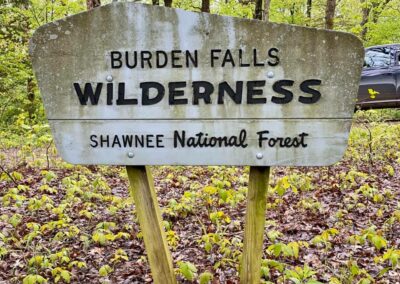
Mc Cormick Trail: Located on Ozark Road about an eighth of a mile west before Mc Cormick/Burden Falls Road. Parking is on the side of the road. There is a ‘Burden Falls Wilderness’ sign on the start of the trail next to a pond with another gated trail across the road from it.
Burden Falls Wilderness Trailhead: Located about a mile east from the waterfall trailhead is another trailhead with limited parking capabilities. You will see a wilderness sign at the parking area.
Caney Branch Trailhead: Located about a mile east of the Burden Falls Trailhead listed above is the Caney Branch Trailhead with limited parking capabilities. Signs for Burden Falls Wilderness and Caney Branch Barrens are present on this trailhead.
Murray Bluff Trailhead: Burden Falls Wilderness could be accessed from the Murray Bluff Trailhead. Users would go up the trail and through Buzzards Roost Hollow and south of that in order to get into the Caney Branch area of Burden Falls Wilderness. Parking is limited to the side of the road here.
Other access points to Burden Falls Wilderness can be found on the nearby Apple Road a few miles form the Ozark Road turnoff although these sections are rarely used and will likely be heavily grown up during the warmer months. Parking in those areas will be on side of the road.
TRAILS WITHIN THIS WILDERNESS AREA
The Mc Cormick Trail is an out and back trail of about a mile in length. The highlights of this trail are the old fire tower (Mc Cormick Fire Tower) foundation. The tower has long been torn down for the steel to be sold off. Trigg Tower is close to this area and is the last partially remaining Fire Tower that you can go up on within the Shawnee National Forest.
The Waterfall Trailhead is the most-visiting area of the Wilderness. A user-made trail consisting of about 1.5 to 2-miles out and back will take you from the parking area to the west and safely down into the ravine in order to get to the base of the main waterfall. You should not attempt to climb down to the right of the topside of the main waterfall as people have fallen and died here. As of 2021, a warning barrier cable with signage has been put into place warning visitors of dangerous conditions. Falling is very easy around the edges on the main waterfall. Is it worth dying for? Emergency first responders may be hours away and cell phone signal in this area is usually non-existent.
The Burden Falls Wilderness Trailhead contains an out and back trail of about 3 to 5-miles which takes users out to the Little Saline River. There is an old bridge present from back when the area was farmland and roads were present.
The Caney Branch Barrens trail will take users all the way to Murray Bluff if they wish to travel it. The hike is out and back and can be as long as the user wishes it to be. From the trailhead to Murray Bluff and back, assume the length will be about 7 to 12-miles in length.
Most of the trails on Apple Road are old forest roads and conditions are usually very rugged. The mileage of these entry points is unknown.
WHAT THIS WILDERNESS HAS TO OFFER
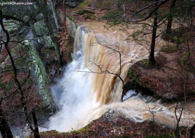
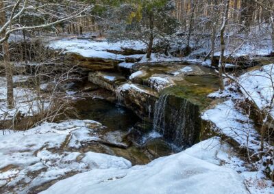
Burden Falls Wilderness has a lot to offer its users. The main feature is the 100-foot waterfall located at the waterfall trailhead. This is the tallest waterfall in the Shawnee National Forest. It falls 20-feet from the top to a ledge below and then an additional 80-feet from there. Please understand for your safety, a fall from this height will likely result in serious injury and even death. People have fallen to their deaths at this location and there are serious injuries from falls here every year. Please do not become a statistic. The topside of the waterfall trailhead features multiple waterfalls that are easier and safer to get to as well and the creek which feeds the waterfalls crosses the road. It should be safe to cross in most vehicles unless during heavy flooding.
The Caney Branch Barrens trail can lead to a Natural Area sharing the same name that has a host of interesting cave shelters, waterfalls and even a natural arch. One of the cave shelters on this trail is known as Pink Cave and consists of wild, pink-like coloration within its rocks.
The Durfee homesite, cemetery and mine (no access into the mine) is also located in this wilderness.
Buzzard Roost Hollow offers some interesting bluff and other sights as well.
SPECIAL CONSIDERATIONS FOR THIS WILDERNESS AREA
Burden Falls Wilderness follows the same guides listed on our Main Wilderness Guide article.
There are no restrooms or trash services at trailhead for this wilderness. Please practice Leave No Trace ethics and pack out what you pack in.
Venomous snakes occur within this and nearby areas including the copperhead snake. Avoid a negative experience with a venomous snake by watching where you step, staying on the trail, giving snakes plenty of room and never attempting to handle or harm a snake.
This area consists of rugged and steep terrain, rolling hills and sometimes very muddy conditions. Accessing this area can be a challenge and is often considered a difficult level of recreation. Please plan accordingly before venturing into this area.
Cell phone signal may not be available in many areas of Burden Falls Wilderness.
EMERGENCY INFORMATION FOR THIS WILDERNESS AREA
WARNING: Dangerous conditions exist within the Burden Falls Wilderness Area. People have fallen in this area resulting in serious injuries and even fatalities. Please do not cross warning barriers put in place to protect public safety. Leave with good memories, not bad injuries!
The nearest hospital from Burden Falls Wilderness is located in the City of Harrisburg, Harrisburg Medical Center which is about 20-miles from the Burden Falls Waterfall Trailhead.
For emergencies – dial 911 and follow the instructions of the 911 operator.
WHAT’S CLOSE TO THIS WILDERNESS AREA?
Eddyville is the closest community to Burden Falls Wilderness. Eddyville is a very small community with very few points of interest. Hangout Campground is in Eddyville and could provide camping opportunities for multiple types of camping users including bikepackers, backpackers, equine, RV/camper and tent camping. Shotgun Eddy’s is a really good bar and grill styled establishment with great breakfast, lunch and dinner as well as adult beverages and a very large outdoor seating arrangement. Equestrians can also camp at Hayes Canyon Campground which is an official permitted equine campground outfitter very close to Burden Falls Wilderness. Unfortunately, the one store/gas station in Eddyville, Shawnee Mart, has since closed down. The City of Harrisburg north of Eddyville is the next best community with multiple gas, food, grocery and other points of interests.
Bay Creek Wilderness Borders Burden Falls Wilderness as well. Lusk Creek Wilderness is a few miles away from Burden Falls Wilderness, too. Other Shawnee National Forest areas of interest close to Bay Creek Wilderness include Bell Smith Springs, Jackson Falls, Sand Cave and Millstone Lake. There are numerous equestrian trails, hiking, cycling, hunting, fishing and kayak/canoe opportunities close to these areas.
VIDEOS OF THIS WILDERNESS AREA
Check out the following video footage of this particular wilderness area.
Thank you for taking the time to read this Wilderness Area Guide. This and the other 6 guides took a while to create and are offered for free of charge. Please consider supporting my efforts of making these guides by sharing them with others, especially on social media. You can also support my efforts by following me on YouTube, Facebook, Instagram, Twitter and the Official Website for Hiking with Shawn. Consider becoming a Patreon Member or purchasing some official merch from the Hiking with Shawn Online Shop. Thanks again for checking out this guide and until next time, I’ll see you on the trail!
Shawn J. Gossman
Host
Shawn is the founder and host of the YouTube Channel, Hiking with Shawn as well as Hiking with Shawn LLC. Shawn hikes, backpacks and visits various forested areas in the Shawnee National Forest, local state parks and other areas promoting outdoor recreational activities to obtain video to show to locals and non-locals alike. Please support Shawn’s efforts by sharing this post and leaving a comment below.

