Hiking with Shawn’s
Trail Guide Series:
Burden Falls Wilderness
Burden Falls Wilderness is a vast 3,700+ acres of a designated Illinois Wilderness Area managed by the US Forest Service under the Shawnee National Forest. Burden Falls Wilderness is very popular both famous and infamous. Famously, the main waterfall at Burden Falls Wilderness is the tallest waterfall in the Shawnee National Forest and is featured in many videos, photos and articles on the web and in books. Infamously, many fatalities and serious injuries have occurred at Burden Falls Wilderness. However, one can safely enjoy a visit to Burden Falls Wilderness by practicing safe acts when enjoying the Shawnee National Forest.
This guide features information of what Burden Falls Wilderness contains in terms of outdoor recreation, how to get there and information important for and around the general area of this wilderness area. The following guide was created by Hiking with Shawn and is in no way officially created by the US Forest Service or Illinois Department of Natural Resources. This guide was created as is and for information and entertainment only. Dangerous conditions exist in this area – please Recreate Responsibly and at your own risk.
Please see the Official Burden Falls Wilderness information page on the US Forest Service – Shawnee National Forest website for official information.
Directions and Stuff!
Click this link to see a map of the Burden Falls Wilderness area created by fellow outdoor recreational enthusiasts. From Ozark Road, turn Northeast onto Burden Falls Road/Mc Cormick Road. Drive for a half of a mile until you see the parking lot on your left. If there has been a lot of rain, a creek will be flowing over the roadway where the parking area is. This creek, Burden Creek, feeds the main waterfalls which are located at this trailhead. Please drive carefully on both Ozark and Burden Falls roads. These roads are gravel-based for the most part and there are many potholes that may do damage to your vehicle if you hit them too fast. The main trailhead parking lot can fit about 6-8 vehicles and will become very busy and packed during the warmer months, especially when the waterfalls are flowing.
Note the sign that dangerous areas exist in this general area. Please understand that fatalities and serious injuries have occurred at this location. Most of these have occurred from falls. Because of its remoteness, volunteer first responders are far away and may take a while to reach fall victims. Cell phone reception generally does not work in this particular area of the forest. Putting safety first is ever more important in this particular area. Wet rock will likely be extremely slick.
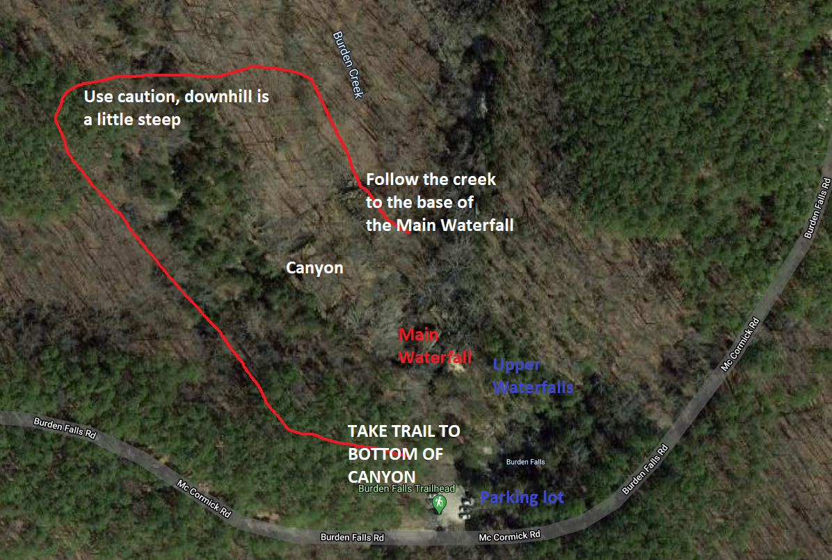
There are no official trails at this location. To reach the upper waterfalls, many people will carefully climb down the rocks across from the center portion of the parking lot (on the side of the parking lot). This area may be slick when wet or in the winter. To reach the bottom of the main falls, when facing the falls area (with Burden Falls Road and the parking lot behind you), a well-used trail to your left will take you down to the main canyon and then to the main waterfall. This about a mile to a mile and a half out and back. This is the safest route to the bottom of the waterfall. Please note that when wet, some parts of the trail may be slippery. Please use caution.
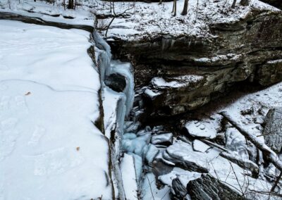
Do not attempt to access the bottom of the waterfall by climbing down the rocks to your right when facing the main waterfall area. Do not walk across the edge of the top of the main waterfall, especially when wet. This area is where most people fall and either have serious injuries or die. If you cross here or get close to the edge – you could fall and die. The bottom consists of nothing but large, jagged rocks limiting your chance of survival. Statistically, most people perish from fall injuries in the Shawnee National Forest – don’t become one of these statistics.
If travelling east on Burden Falls Road past the main parking lot, there will be two additional trailheads. These trailheads may be difficult to park some vehicles when wet due to mud. The trails associated with these two trailheads are often used by horseback riders – please ensure that you yield to riders and speak to them in a calm manner so that the animals know you are not a threat. These trails are not blazed, and they are out and back. Many user-made, illegal trails exist off of them and those are also not marked. You can also access Burden Falls Wilderness from other points including the Mc Cormick Fire Tower Trail (the fire tower is no longer there) and gated forest trails via Apple Road.
What you will see!
The main trailhead for Burden Falls Wilderness is the most popular spot. In the warmer and wetter months, you can expect a lot of visitors at this location. At times, it will be a challenge to visit, park and even drive on the road near this trailhead. Please keep in mind that people live on this road and it’s important to keep the road clear for those driving on it. There is no designated parking along the road – doing so may risk towing and citation fees. Forest Service Law Enforcement, State Police and Pope County Sheriff Deputies patrol this section very often.
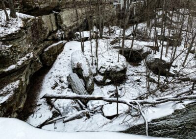
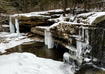
At the main waterfall trailhead, within a couple of feet where you park – you have a chance to see very nice flowing waterfalls. This is especially nice for those with limited mobility who are not able to walk or hike long distances. The upper falls are beautiful and there are several one them. Photographers don’t even have to do any major climbing to shoot photos of the upper falls making it one of the most photogenic areas of the Shawnee National Forest. The main larger waterfall is also a sight to see. It is described as the tallest waterfall in southern Illinois and in the Shawnee National Forest. It is a very popular attraction but sadly, those trying to access it in dangerous ways often fall leaving with serious injuries or they pass away. Please be careful when visiting this area – safety is at the utmost importance in this particular area.
The Mc Cormick trail (on Ozark Road right before the turn to Burden Falls Road) is an out and back trail with the foundation of the old fire tower being the most prominent feature of the hike.
The Burden Falls Trailhead (east of the main waterfall area) is an out and back trail consisting of a few miles which will lead to the Little Saline River. The area of the river contains an old bridge that was once used before the area was a National Forest. This trail is often used by horseback riders and contains little to no prominent features.
The Caney Branch Trailhead (down the road from the Burden Falls Trailhead) consists of old home sites, mines and a cemetery once used by the Durfee family. This area also contains interesting bluffage, waterfalls, natural arches and cave shelters in the natural area of Caney Branch Barrens. There are no official trails to access the barrens – you will need a GPS or app and understand how to follow it. This area will also take you to the Buzzard Roost area near Burden Falls Wilderness. That area is often used by ATVs and jeeps just for your information.
Aside from the waterfalls, Burden Falls Wilderness has over 3,700 acres of hardwood forest with some pine plantations. There are a number of scenic creeks that can be seen throughout the wilderness area. Dispersed camping is allowed in Burden Falls Wilderness and the vast amount of wilderness area will give backpackers plenty of space and options to camp. Camping at trailheads and natural areas is prohibited. Using a bicycle or motorized (gas or electric) vehicle to access Burden Falls Wilderness is not allowed.
Nearby Attractions and Sights!
There are only a few places to eat near this particular area. We suggest checking out Shotgun Eddy’s in Eddyville for great burgers, breakfast and cold drinks. Indoor and outdoor seating arrangements are possible. For great BBQ, check out Murphy’s Pit BBQ off Ozark Road.
Other hiking destinations in this area include Jackson Falls, Bell Smith Springs and Trigg Tower. For camping areas, check out Red Bud Campground for cheaper non-electric sites or Hangout Campground in Eddyville for electrical sites. Those looking for horse/horse trailer camping should check out Hayes Canyon Campground in Eddyville.
For more recreational areas and points of interest in southern Illinois, check out this map.
Safety Tips and Information!
In order for best experience possible at Burden Falls Wilderness, it is highly recommended to practice the following important suggestions:
- People have died in this area from fatal falls. Please don’t become one of them. Always put safety first, know that wet rock will be extremely slick and leave the Shawnee with great memories, not bad injuries.
- Cell phone reception will likely be non-existent in this area of the forest. Let someone know where you are going before you go and try to visit with a friend if you can.
- Please Recreate Responsibly when visiting this area. Pay attention to public health and agency guidelines and practice appropriate social distancing procedures during your visit.
- Bring plenty of fluids and snacks in order to stay hydrated and fueled for your visit. The area is rugged with rolling hills and proper hydration is important.
- There are no trash services at Burden Falls Wilderness. Litter can harm the forest wildlife and natural features. Please pack out what you pack in and Leave No Trace.
- Please make sure all campfires are cold to touch and completely put out before leaving your dispersed camping area. Only You can prevent wildfires!
- Please use designated parking. Please do not park along the roadway as it may hinder local traffic of those who live in the area as well as emergency personnel.
- Venomous snakes, poison ivy and dangerous conditions occur within this area. Please use common sense and always watch your step.
- During hunting season – this area is commonly used for bow, muzzleloader and shotgun hunting activities. Please use caution during hunting season and share the forest!
How to Safely Access Bottom of Waterfall
Watch the videos for this trail!
Below is a recent video that we filmed while enjoying this area.
One last thing!
Filming the videos, taking the photos, editing everything and writing this article takes time and it’s all provided for free. Consider making a small monthly contribution to Hiking with Shawn by becoming an official Patreon supporter on Hiking with Shawn! You can also support us by purchasing official merch from the Hiking with Shawn online store. Lastly, please share this article and our videos and follow us on YouTube, Facebook, Twitter, Instagram and Tumbler for more free guides, videos, photos, contests and more!
Thanks for checking out this guide and please share it with others if you’d like to see more of them made!
Shawn J. Gossman
Host
Shawn is the founder and host of the YouTube Channel, Hiking with Shawn as well as Hiking with Shawn LLC. Shawn hikes, backpacks and visits various forested areas in the Shawnee National Forest, local state parks and other areas promoting outdoor recreational activities to obtain video to show to locals and non-locals alike. Please support Shawn’s efforts by sharing this post and leaving a comment below.

