Hiking with Shawn’s
Trail Guide Series:
Cedar Creek Wonders
Cedar Creek Wonders is a uniquely presented feature of the Shawnee National Forest located in the more middle section of the Shawnee Purchase Unit. Cedar Creek Wonders is an excellent waterfall chasing spot for the most part, but the area also runs beside the River to River Trail as well. If you’re thru-hiking or section hiking the River to River Trail and you have time, defiantly make a detour to follow Cedar Creek for some awesome sites, especially if we have had any rain recently. Aside from waterfalls, this area has supposed Native American rock art, scenic creeks, amazing bluffage and so much more to see and experience. Cedar Creek Wonders is a favorite of many thru-hikers, day hikers and equestrian riders. Defiantly add Cedar Creek Wonders to your bucket list of areas to visit within the Shawnee National Forest in southern Illinois.
WARNING: Dangerous conditions are present in this area. Serious injuries to even fatalities have occurred in or near this area from falls off high bluffs. Please use extreme caution and enter this area at your own risk. This article is intended for entertainment and educational purposes and is considered “as is”. Check out my Ultimate Safety Guide for the Shawnee National Forest for more vital safety information about your visit to the National Forest.
Cedar Creek Wonders is managed by the US Forest Service Hidden Springs Ranger District for the Shawnee National Forest.
Trails in this area include both out and back, lollipop and loop specific trails equaling to about 9 to 1-miles with right under 1,000’ max elevation gain. This area would be considered extremely rugged due to hills, many creek crossings, very rugged trail conditions and steep terrain. Proper footwear, clothing and gear will be required to hike this area safely. This area is not handicap or young child friendly as far as hiking difficultly goes.
Area Directions and Trail Information
Check out this map for points of interest around the Cedar Creek Wonders area. Hiking with Shawn would like to give special recognition to Joe Littleton for much of the navigation, geocaching, and trail/feature naming in this area.
If traveling from Vienna, Illinois, at the Route 45/Route 146 intersection, drive EAST on IL-146 for 1.5 miles, passing under I-24 and turn left (NORTH) on IL-147 and drive 6.4 miles until you reach Gilead Church Road on your left. Turn left (NORTH) onto Gilead Church Road and drive for 0.8 miles to Gum Springs Road and turn right. Drive 1.6 miles until you see the trailhead on your left right after you cross a concrete bridge. The River to River Trail crosses right here. The trailhead has official US Forest Service signage on the main road right before it.
Try to park on the edges, away from the middle, as horse trailers are also parking here. Please make sure trucks and trailers have plenty of room to get in and out of this parking lot. There is enough room for 3 to 4 horse trailers and 6 to 8 cars as long as everyone parks responsibly. All roads leading to the trailhead are paved asphalt roads. The trailhead itself is gravel. There are no water fountains, picnic tables, grills, or restrooms available at this trailhead. There is no trash service at the trailhead – please pack out what you pack in and help us keep Our National Forest clean!
The first trail I recommend is the Buffalo Rock Trail, which is located on the northern portion of the trailhead and parallels the creek to your west. This is an out-and-back, hiker-only trail that is about a mile in total hiking out and back. For the most part, the trail ruggedness is moderate. It will eventually stop at a large cluster of boulders. However, there is evidence of a trail across the creek but in most cases, the creek is often too deep to cross. Although this trail is hiking only, there are signs of previous equestrian use, so do watch out for that.
To see the little arch and waterfalls, you need to take the River to River Trail. From the trailhead, walk onto the side of the road and go over the concrete bridge. Please use caution, as drivers on the road may not see you in time if they are distracted or driving too fast. Cross the bridge and take the River to River Trail to your right (WEST). Follow this trail to see the bluffage, small arch, waterfalls, and scenic creeks. There is a user-made trail to every waterfall in this particular area. It is good to have a topo map or app to keep yourself close to the creek and creek fingers, which is where most of the waterfalls will be.
Check out this link to my Strava map for this entire area. Check out this link for the River to River Trail Guide, which is free, updated frequently, and online and shows the area for Cedar Creek Wonders. I suggest using the smartphone app Avenza when hiking in this area, and the River to River Trail Bundle is also free.
Area Points of Interest and Sights
Along the Buffalo Rock Trail, which is about 1 mile out and back, you will see a very scenic creek to your left and interesting bluffage to your right. The creek to your left will have many points where you can walk off trail carefully and take really nice photos of the fairly clear and often bluish water. The backdrop of tall bluffage behind the creek on the other side really makes the area scenic and wild.
The bluffage on your right features many different shelters of all sizes, great frozen waterfall locations during the winter months, a make-shift bushcraft shelter that has been present for many years (looks like a machine gun deck almost) and of course, Buffalo Rock, which is located at coordinates, 37°30’03.9″N 88°45’41.0″W. Buffalo Rock is faded a lot. It will be hard to see and it will continue to be harder to see each year. It is said to be a buffalo pictograph created by Native Americans. It has been retraced/repainted by various people over the years. The shelter around it has signs of chert most likely left behind by Native Americans. Do note that it is illegal to dig for and harvest ancient artifacts from the Shawnee National Forest.
On the River to River Trail, heading towards the waterfalls, you will be seeing an assortment of different things. After about a mile of hiking, you will come to see some larger older trees and an old home site area to your right. There is some foundation present as well as an unprotected open well that you should use extreme caution around. This area looks best in the spring when the daffodils are in bloom. The homesite is located at these coordinates, 37°29’42.2″N 88°46’20.3″W.
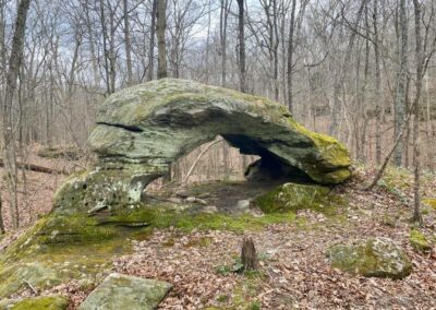
The tiny arch which is called Easter Basket Arch is located at these coordinates, 37°30’14.6″N 88°46’54.1″W. Easter Basket Arch is a natural arch and probably once of the smaller ones in the Shawnee National Forest. You could sit or lay under it and you could walk over the top of it. I have seen videos of mountain bikers riding over the top of the arch. It is probably one of the most unique natural arches that I have ever seen in the Shawnee National Forest.
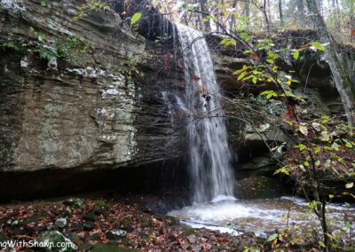
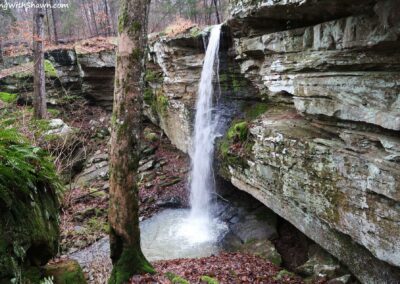
There are several waterfalls along the creek and the fingers of the creek. On wetter days, I would suggest taking the user made trails that are close to the creek and its fingers and finding the waterfalls that way which shouldn’t be too difficult aside from the area being pretty rugged and steep in some spots. You defiantly want to wear appropriate hiking footwear for this not crocs or sandals. Easter Basket Waterfall is located at these coordinates, 37°30’03.1″N 88°46’52.4″W. JD Waterfall is located at these coordinates, 37°30’18.2″N 88°47’11.9″W. While the Easter Basket and JD Waterfalls are the more popular waterfalls in the area, if you follow the creek, you will find more waterfalls that are worth seeing especially on the wettest of days. However, wet will mean that conditions are very dangerous – please use extreme caution.
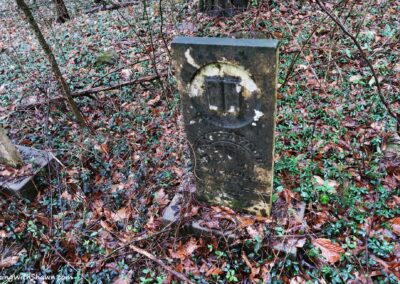
There is an old homestead and cemetery site within this area. At one time, there was a geocache located around here as well. In fact, there have been several geocache sites within the Cedar Creek Wonders area in case you are into that sort of thing – which is a lot of fun! The old homestead and cemetery have an information sign explaining about the settlers of this area. It is very informative and education if you enjoy local history. However, the cemetery can be harder to get to during the summer months and it is very easy to pass up without realizing it is there. The coordinates to this area are 37°30’31.5″N 88°47’08.5″W.
I will note this: Some folks have tied Christmas and holiday ornaments to trees out in this area. I don’t wish to promote this because it is practically a form of litter. It really takes away from the natural beauty of the forest and I cannot ethically support or promote it which is why those locations will not be listed in this guide. I actively throw away stuff like this as well because after all, it’s litter.
Area Safety and Important Information
Dangerous conditions exist in this area including slip, trip and fall hazards around high bluffs, cliffs, hilly terrain, and steep trail conditions. Serious injuries to even fatal falls have occurred around this area in the past. Always put safety first, watch every step, use common sense, and proceed with extreme caution when visiting this area.
Cell phone data and coverage is often limited to completely unavailable in this area. If you become injured and cannot travel or lost, making an emergency phone call may be difficult. Due to the area’s remote and rural environment and the fact that local first responders are volunteer; emergency service could take several hours to get to you.
Always tell someone where you will be hiking before you leave and try not to hike alone. Check out Southern Illinois Hiking & Outdoor Recreation on Facebook to find local hiking buddies near your area. This group is managed by Hiking with Shawn and has over 14,000 members.
Poison ivy and other irritant-based plants occur in this area.
Venomous copperhead snakes occur in this area.
Wear appropriate hiking footwear and clothing as the trail conditions are often rugged and wet. Creek crossing is required and at times, the creeks are deep enough where they will go over your boots.
Bring plenty of water and snacks with you.
This area is shared by hikers and horseback riders. If you encounter a horseback rider, yield for the rider while taking to them in a normal voice. This will help the horse know that you are a human and not a threat. We often look scary to horses and that could endanger the rider. Don’t be discouraged to hike where horses are, though! Read my Guide to Sharing the Trail with Horseback Rider in the Shawnee for more information about this topic.
There are no trash services in this area. Please pack out what you pack in, pick up any other trash you might find and practice Leave No Trace steps when hiking in this area.
As always, please Recreate Responsibly so that all visitors can enjoy this area safely.
Area Nearby Attractions, Eating, Lodging and Local Information
There are many other outdoor recreation areas around Cedar Creek Wonders. For a great view of the forest, check out the nearby Trigg Lookout Tower. For hiking, check out Max Creek. For horseback riding, enjoy the trails around East Trigg. For cycling, be sure to ride the nearby Tunnel Hill State Trail. With permission, during off seasons, check out the trails at Camp Ondessonk which is very close to this area. The camp is also good for your kids if you are looking for summer camp opportunities.
For lodging in this particular area, many thru-hikers will camp along the River to River Trail at least 200’ off trail, away from bodies of water and not within natural areas. No permit is needed to disperse camp in the Shawnee National Forest. During non-camp seasons, Camp Ondessonk has been known to rent out its cabins to the public. Camping is available at Bell Smith Springs and RV hookups can be obtained at Shawnee Forest Campground in Vienna. Check out Cedar Lake Campground for equestrian camping needs.
For dining in this area, the nearby city of Vienna has many options, including Ned’s Shed for good burgers, Vienna Diner for good breakfast and lunch options, and Family Pizza for great pizza. When dining in our area, please consider shopping at the local mom-and-pop places because of the chain stores. Mom and Pop will give you a better experience, and it will help keep southern Illinois and the Shawnee National Forest unique and interesting.
Watch the videos for the Cedar Creek Wonders trail!
Below is a recent video that we filmed while enjoying this area.
One last thing!
Filming the videos, taking the photos, editing everything and writing this article takes time and it’s all provided for free. Consider making a small monthly contribution to Hiking with Shawn by becoming an official Patreon supporter on Hiking with Shawn! You can also support us by purchasing official merch from the Hiking with Shawn online store. Lastly, please share this article and our videos and follow us on YouTube, Facebook, Twitter, Instagram and Tumbler for more free guides, videos, photos, contests and more!
Thanks for checking out this guide and please share it with others if you’d like to see more of them made!
Shawn J. Gossman
Host
Shawn is the founder and host of the YouTube Channel, Hiking with Shawn as well as Hiking with Shawn LLC. Shawn hikes, backpacks and visits various forested areas in the Shawnee National Forest, local state parks and other areas promoting outdoor recreational activities to obtain video to show to locals and non-locals alike. Please support Shawn’s efforts by sharing this post and leaving a comment below.

Thanks again for yet another wonderful write-up! We’ve been in this area multiple times and hadn’t heard of this place until I found your blog, so we’ll definitely check it out. Speaking of “definitely”, I believe that was the word you were looking for twice in the first paragraph when you said “defiantly” instead. I apologize for being “one of those people”, but you write so well, I thought you’d want to know! 😊
Appreciate it. I do make typos here and there, haha.