Hiking with Shawn’s
Trail Guide Series:
Horse Creek Trail
Horse Creek Trail is a moderately rugged 5.7-mile loop trail located near McClure, Illinois in Alexander County. This trail is a part of the Shawnee National Forest and is maintained by the Mississippi Springs Ranger District. This trail is shared by both hikers and horseback riders, alike. This trail is best to visit during late fall, winter, and early spring for the best results. Most of this trail follows ridge lines but does contain some features including Horse Creek. The elevation of this trail is 500’ max elevation but the ruggedness is based on creek crossings, overgrowth and annual trail maintenance.
Dangerous conditions exist in this area. People have been injured and may have even died while recreating near this area. Please use extreme caution and always put safety before all else. Tell someone where you are going and try not to hike alone. Cell phone signal is usually unavailable in this area. Because of the lack of cell phone signal and the remoteness of the area, first responders responding to an emergency many take several hours.
This trail is not recommended for beginners, young children, or handicap forest users.
Horse Creek Trail Directions and Trail Information
Please see this map for general points of interest for the Horse Creek Trail.
If driving from Carbondale, Illinois – Take Illinois Route 13 west for 8.8-miles until you reach Illinois Route 149 in Murphysboro. Take R-149 west for 6.2-miles until you reach Illinois Route 3. Turn left (south) onto R-3 and drive 32.8-miles until you reach Grapevine Trail in McClure, Illinois. Turn left onto Grapevine Trail and drive 4.7-miles until you reach a gravel Forest Service Road (FSR-220). It will look like a private driveway, but it isn’t. A sign for FSR-220 is on the right but can be hidden from overgrowth during the summer months.
Turn right onto Forest Service Road 220 and continue down the road. Drive slowly as the road is narrow and in case you meet other traffic coming from the other way. At one point, you will reach a fork in the road. Take the RIGHT road. The left road goes to a chunk of private property. Drive down the RIGHT road all the way to the end. There is enough parking for about 3 or 4 vehicles. Horse trailers will have a hard time getting in and out of this area – seek alternative parking.
There is no drinkable water sources, restrooms or trash services located at this trailhead. There are no information signs or kiosks located at this trailhead. There are some blazes present indicating trail number 220 which is the FSR number. Trees are down about 2 miles into the trail if starting the from the very end of the road. The trail before the end of the road is where the loop will come out at. That portion of the trail is FSR-686.
Because of some areas with trail/road intersections at the lower end of the halfway point, it is strongly recommended that you use a GPS or app such as OnXHunt (not sponsored) to navigate this trail or you could become lost or off the correct trail.
The lower end has been rerouted about a mile from the end of the trail. It is marked with orange ribbon. The reroute appears to be due to heavy amounts of trees that have come down.
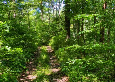
The lower area near the creek is heavily overgrown and full of stinging nettle during the summer months. Pants are recommended as you will come into contact with the nettle if you remain on the trail.
Horse Creek Trail Attractions and Points of Interest
I recommend you visit Horse Creek Trail during the months of fall color changing as there are numerous areas that will overlook the Shawnee National Forest and provide a scenic fall color setting. The overlooks are not as good as other, though. Due to the overgrowth, lack of maintenance and stinging nettle – I recommend waiting for leaf down before doing the whole loop. It was struggle for us to complete it because we had to dodge so much nettle and downed trees.
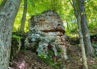
About a mile in if hiking counterclockwise, there are some areas of bluffage to your right just right off the trail down one of the ridges. Please be careful if you go down them as they can be steep. It isn’t a lot of bluffage but what is there has some pretty cool formations and could make for a good photogenic scene.
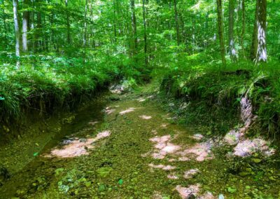
I think the grand finale of the area is Horse Creek itself. It is a lot like the Hutchins Creek scene and shares the elements of the other Illinois Ozarks look. You might be able to follow the creek for a while as an alternative to using the trail if the creek is dry.
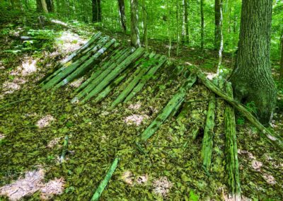
Towards the end as you go up the hill to the main gravel road, you will see an old bridge structure on your right. It looks like a bridge at least but it is no longer over anything. I don’t know the history on it, and I wonder its age in case anyone else might know. It is interesting, though.
While there isn’t a lot to see on this trail, it made for a nice 5-mile hike through the Shawnee National Forest but I think it will look way better during fall color changing season and during leaf off when it is much cooler.
Horse Creek Trail Safety and Important Information
Venomous copperhead and timber rattlesnakes occur in this area. Please watch your step and give plenty of room to snakes if you encounter them. Note that is illegal to harass, harvest or kill snakes on National Forest land.
Dangerous conditions exist here. There are high and steep portions of the trail on these ridgelines. Please use caution as falls from these areas could result in severe injury to even death.
This area could flood during wetter conditions.
This area is extremely remote and cell phone signal is usually unavailable. Please use caution and understand that due to the remoteness and rugged terrain of the area, emergency response could take several hours.
Please tell someone where you are going before you go and try not to hike alone. Join us at Southern Illinois Hiking & Outdoor Recreation on Facebook to find a hiking buddy as there are over 15,000 members on the group.
The lower end of the trail has a lot of stinging nettle. This plant may mildly to severely irritate your skin if you come into contact with it. Nettle can easily penetrate synthetic materials such as cotton, jersey, and spandex.
Mosquitoes, biting gnats and biting flies as well as multiple species of ticks occur in the area. It is recommended that you use the right insect deterrent to help prevent bite and diseases from these pest insects.
From time to time, an encounter from a black bear, gray wolf or mountain lion could occur in this area if the animal is passing through. However, there is no reported population of these animals in this area. Please see my Bear, Wolf and Cougar Safety Guide for more information.
Horseback riders share this trail with hikers. Please always yield to horseback riders and calmly talk to them so that their horses know you are human and not a threat to them. See my Horseback riding and hiking safety guide for more information.
For more tips of your safety in the Shawnee National Forest, see my Ultimate Safety Guide.
There are no trash services located at this trail. Please pack out what you pack in and help us keep our National Forest clean. Follow the practices of Leave No Trace.
Always Recreate Responsibly when visiting the Shawnee National Forest to help keep yourself and others safe during uncertain times.
Nearby Attractions, Dining and Lodging Information
For more outdoor recreation opportunities, we recommend visiting Horseshoe Lake south of this trail. At Horseshoe lake, you can enjoy hiking and bicycling trails, kayaking, fishing, and hunting. Fort Defiance State Park in Cairo is the southernmost Illinois state park where you can see the confluence of the Ohio and Mississippi Rivers.
For local area dining, we recommend Brick House located in the Anna-Jonesboro area. For other dining and winery options, visit Hickory Ridge Winery, Von Jakob Winery & Brewery, Alto Vineyard and Hedman Vineyard. Rendleman Orchards is also located nearby which sells fruit, local made and grown food and more.
For lodging solutions, camping is available at Trail of Tears State Forest and Pine Hills Campground. For cabin camping, check out Rustic Hideaway Cabins near Jonesboro.
Watch the videos for this trail!
Below is a recent video that we filmed while enjoying this area.
One last thing!
Filming the videos, taking the photos, editing everything and writing this article takes time and it’s all provided for free. Consider making a small monthly contribution to Hiking with Shawn by becoming an official Patreon supporter on Hiking with Shawn! You can also support us by purchasing official merch from the Hiking with Shawn online store. Lastly, please share this article and our videos and follow us on YouTube, Facebook, Twitter, Instagram and Tumbler for more free guides, videos, photos, contests and more!
Thanks for checking out this guide and please share it with others if you’d like to see more of them made!
Shawn J. Gossman
Host
Shawn is the founder and host of the YouTube Channel, Hiking with Shawn as well as Hiking with Shawn LLC. Shawn hikes, backpacks and visits various forested areas in the Shawnee National Forest, local state parks and other areas promoting outdoor recreational activities to obtain video to show to locals and non-locals alike. Please support Shawn’s efforts by sharing this post and leaving a comment below.

