Hiking with Shawn’s
Ultimate Trail Guide Series:
LaRue Pine Hills
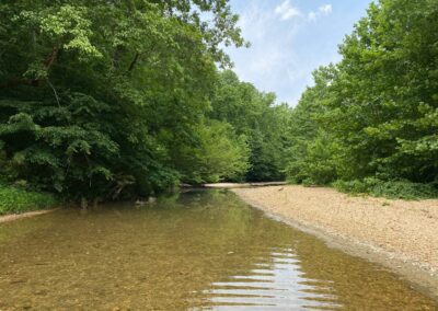
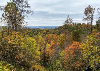
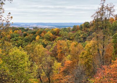
LaRue Pine Hills is one of my favorite areas to visit throughout all the seasons of the year but especially during the spring and during the fall. LaRue Pine Hills is home to the world-famous Forest Service Road known as Snake Road where snakes and other critters can migrate under the protection of the US Forest Service in coordination with Illinois Department of Nature Resources. Since the pandemic started, more and more people are getting outdoors and visiting these recreational and natural areas and it is a good thing. But upon creating this guide, I also want to express the importance of visiting an area like LaRue Pine Hills with a protective mindset. This is a special place that we need to treat in a special manner in order for generations after us to enjoy. Please share this guide with others and I hope you enjoy your visit to LaRue Pine Hills.
LaRue Pine Hills Directions and Trailheads
Check out this map for general points of interest around the LaRue Pine Hills area.
If driving from Marion, Illinois – from Route-13, get onto Interstate-57 SOUTH and drive for 23-miles. Merge onto Exit-30 (Anna/Vienna) and turn RIGHT onto Route-146. Drive 5.8-miles on Route-146 until you reach the stop sign. Turn left to stay on Route-146, crossing the railroad tracks. Drive 1.4-miles and go onto the roundabout, taking the second exit to remain on Route-146. Continue driving 7.7-miles until you reach Route-3. Turn RIGHT onto Route-3.
There are several ways from here to reach different points of the LaRue Pine Hills area, let’s look at the different routes to different area points of interest:
Snake Road/Winters Pond North Trailhead:
Drive 8.9-miles (passing through Wolf Lake) until you reach Muddy Levee Road right before the Big Muddy River crossing. Turn right onto Muddy Levee Road.
Muddy Levee Road is wide enough for two vehicles on each side, but the road is gravel and has many potholes in it – please drive with caution. This road is often used by farmers. During river flooding, Levee roads like this one are very sensitive and should not be used. In most cases, the road will be closed if the water is really high as it becomes a danger for those using the road. Levees have been known to fail or breach.
Drive on Muddy Levee Road until you get to the T (about 2.7-miles). Turn RIGHT and drive 20-feet to reach your destination, the NORTH TRAILHEAD for Snake Road.
This trailhead has multiple spaces for parking. Please do not block the gate or park in the road where it causes the road to be blocked. There are picnic tables, grills, and a trash can at this trailhead. Please throw away trash in the trash can or take it with you. Please help us keep this very sensitive area clean from garbage. Wildlife depends on it!
Snake Road/Otter Pond South Trailhead:
From Route-3 in Ware, turn RIGHT and drive 7.7-miles (passing through Wolf Lake) until you reach LaRue Road. Turn right onto LaRue Road and drive 1.3-miles to reach your destination, the SOUTH TRAILHEAD for Snake Road. There are very limited parking options available at this trailhead as it was not developed to be an actual trailhead like the north trailhead. There are no trash services, picnic tables or grills at this trailhead. Please do park in a manner of where you block the roadway or the gate. Pack out what you pack in and help us keep this area clean – the wildlife there, depends on your help!
Pine Hills Campground:
From Roue-3 in Ware, turn RIGHT and drive 4.2-miles towards Wolf Lake to State Forest Road. Turn RIGHT onto State Forest Road and drive 0.6-miles to Pine Hills Road. Turn LEFT onto Pine Hills Road and drive 0.7-miles to reach your destination, the entrance to Pine Hills Campground. Pine Hills Campground is a fee-site managed by the US Forest Service. Please see the official website for the campground here for more information of features, availability, and fees. Do take note that during snake migration and hunting season, this campground will likely fill up quickly.
White Pine Trailhead:
From Pine Hills Campground using the driving directions above, pass the campground and continue to drive for 2.3-miles until you reach White Pine Trailhead on your RIGHT. There is enough room for about 2-4 vehicles to park. Please do not block the road as this area is a blind spot and could be a road hazard for vehicles parked in the roadway. White Pine Trail ends at Pine Hills Campground. Pine Hills Road is gravel and potholes are present – please drive carefully.
McGee Hill Trailhead:
From White Pine Trailhead using the driving directions above, pass the trailhead and continue to drive for 0.6-miles until you reach your destination on your RIGHT, the McGee Trailhead. A vault-styled restroom is located at this trailhead.
McCann Springs Trailhead (Long Way to Inspiration Point):
From Route-3 in Ware, turn RIGHT.
Drive 8.9-miles (passing through Wolf Lake) until you reach Muddy Levee Road right before the Big Muddy River crossing. Turn right onto Muddy Levee Road.
Muddy Levee Road is wide enough for two vehicles on each side, but the road is gravel and has many potholes in it – please drive with caution. This road is often used by farmers. During river flooding, Levee roads like this one are very sensitive and should not be used. In most cases, the road will be closed if the water is really high as it becomes a danger for those using the road. Levees have been known to fail or breach.
Drive on Muddy Levee Road until you get to the T (about 2.7-miles). Turn LEFT and drive for 0.4-miles and turn RIGHT onto Pine Hills Road. Drive for 370-feet to reach your destination on your right, the McCann Springs Trailhead. There is adequate parking available at this trailhead. Please do not park on the roadway.
Inspiration Point Trailhead (Short Way to Inspiration Point):
Using the directions above, pass McCann Springs Trailhead and drive for 0.7-miles (going uphill) until you reach the trailhead on your right for Inspiration Point. There are parking availabilities but please do not block the roadway. Be careful driving up to this trailhead as the road become narrow and sharp at curves and turns. There is a significant drop off the side of the roadway – use extreme caution.
Godwin Trailhead West (Access to Clear Springs Wilderness Area):
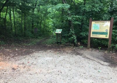
Using the directions above, pass the Inspiration Point trailhead, continue driving for 0.3-miles until you reach Godwin Trailhead West on your left. There is enough parking for about 2-4 vehicles. Please do not block the roadway as this area of the road could be hazardous to blind spots.
General Warning Information: This area is rural and remote meaning that roadwork, snow/ice removal and emergency response time is very limited in this area. Cell phone signal is often little to none in this area as well. Please use caution when visiting this area. During heavy rains, much of the lower portion of this area is subject to flooding. Because of rivers, swamps, and slough areas – ticks, biting flies/gnats and mosquitoes tend to be thicker in this general area – make sure you are taking steps to protect yourself from these biting/disease-spreading insects. This area is popularly used by hunters during bow and shotgun hunting seasons. Venomous snakes occur in this area of the forest more so than other areas of the forest and such wildlife is extremely protected from harm, harassment, and collection.
LaRue Pine Hills Points of Interest and Recreation
There is a lot to do in the LaRue Pine Hills area. The following Points of Interest can be found using the directions to these places in the section of this article directly above this section.
Snake Road:
Hiking with Shawn officially recommends that you purchase LaRue Pine Hills-Snake Road Guidebook written by Joshua Vossler. This comprehensive guidebook covers everything you need to know about visiting and enjoying Snake Road. This book also includes many photos to help you identify the wildlife you might find along this road. This book is available online at Amazon, SIU Press or for purchase in-person at the Cache River Wetlands Center.
Snake Road is the nickname of Forest Service Road 345 which is a 2.5-mile stretch of narrow gravel road extending from north to south. The south trailhead (with very little parking availability) can be accessed at the end of LaRue Road and the north trailhead (a lot of parking availability) can be accessed at the end (right at the T) of Muddy Levee Road. The road is closed (gated) two times a year so that wildlife can migrate across without harm from vehicles. Foot traffic is welcome during the closure. Motor vehicles, horses and bicycles are PROHIBITED from using the road during the closure.
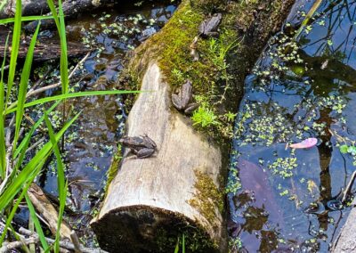
Much of the type of wildlife that migrates are snakes which is why the Forest Service Road is called, Snake Road. As far as one can tell, it is the only road in the United States that strategically closes for snakes to safely migrate across. There are more than 20 species of snakes that cross this road during migration including Garter snakes, ring-necks, mud snakes, water snakes, earth snakes, hognose snakes and also the three venomous snakes’ cottonmouth, copperhead, and timber rattlesnakes. There are also rare snakes in this area as well including Mississippi Green and flathead snakes. Though there has not been any published observation since the 1950s, it is said that the Scarlet snake may also occur in this area, but it is very unlikely that the snake occurs there.
Snake Road is closed once in the spring (usually March 15 to May 15) so that snakes can migrate from the bluffs to the swamp areas. Then, the road is closed during the fall months (usually September 1 to October 30) so that snakes can migrate from the swamp area to the bluffs to “hibernate” during the colder winter months. Sometimes the road is closed sooner and opened later due to a change in migration activity in an attempt by the US Forest Service to help protect the movement of the wildlife.
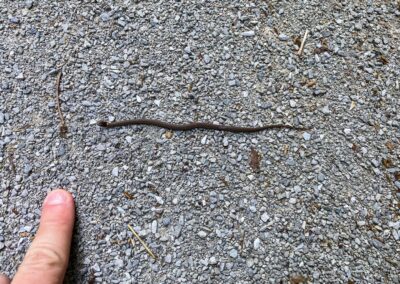
During the migration periods, visitors will park at the trailheads and walk the road looking for snakes and other wildlife. Some visitors visit for birding, mushroom hunting and to view wildflowers and plants during different seasons. During the migration, snakes of many different sizes will likely be sunning and moving across the road. It is especially important for visitors to look where they step so that they don’t accidently step on smaller snakes that are harder to see. Visitors should consider staying on the road for the best chance to see snakes and to avoid putting themselves in a situation where they or the wildlife may be hurt. User trails can harm the ecosystem and cause trouble for the snakes and wildlife that occur in this area and depend on this area.
It is important to know the rules of the road at Snake Road. Absolutely no handling or touching of snakes is allowed. This means you can’t pick them up or use any sort of tool to move them. No hooks. No tongs. No pillow cases. And don’t try to use a stick or your trekking pole. Collecting snakes is also prohibited as they are a protected form of wildlife in this location. Harming the snake in any way is prohibited. Harassing the snake is also a big NO and this also means blocking the snake from freely moving in the direction that it wants to move in. Violating these official rules in order to get a perfect picture is unethical and those who do it and get caught deserve to get fined. If you get caught violating these rules, expect at least a ticket but you can also face arrest. Plain clothed law enforcement does walk the road and dedicated fans of the road are on the lookout for rule violators and they notify law enforcement including me. If I see something, I will video for evidence and report it. On that note, don’t try to be a hero and get yourself hurt.
If you see something suspicious, please contact Forest Service Law Enforcement at 618-201-3364 to report the activity. This may be people handling snakes or in possession of a snake hook. Some people may have permits but it is not your job to find out. Attempting to find out could also result in you getting hurt as well. Don’t risk it – let law enforcement do their job. The number above can be called, or you can text reports to it. You can also remain anonymous if you want to. If you happen to see something handling, harming, or killing snakes on federal or state public land in Illinois on the internet, please consider taking a screen shot and then contacting the law enforcement for the public land to report it. These people are not friends of snakes – they only ruin it for everyone, and we should band together and report them.
Many people often wonder when the best time is to visit Snake Road. During migration, the road will be most busy on the weekends. Most people are off work and looking for something to do. When the road is busy, snakes are less seen. Snakes do not like to interact with people as they fear us. I often recommend folks to visit to see snakes through the work week rather than the weekends. I visit during the weekend because I enjoy the company of other visitors. I’ve made a lot of friends and have met a lot of fans while visiting Snake Road. You will find me there mainly on the weekends. As for when the snakes are most active, there are different theories, but I find it best to visit on sunny days when the temperature is starting to change during nighttime hours. If it is too cold, snakes will either not be out or really close to the bluff. If its too hot, you probably won’t find them out as much either. But when you do find that sweet spot to visit, you’ll know it.
And for those of you who hate snakes, hear me out on this one. Snakes are more scared of you than you are of them. We are 100x larger than snakes and we move way faster than them and they know this. Since they have to arms or legs and just a mouth – of course that will be their only defense. So, when you see a cottonmouth gaping, that is all that it can do to warn you to leave it alone. Snake bites to humans do happen in Illinois and sometimes it is a venomous bite that requires expensive medical treatment, but no one has died from a snake bite death in the State of Illinois for at least 250 years based on my extensive research. Prove me wrong if you can, go ahead! So, before you hate a snake, you might consider the facts first. Dogs kill more people (children more than adults) in a year than snakes kill in a decade. But who can go around hating all dogs? Food for thought, folks!
Please be ethical about visiting and promoting Snake Road. As the pandemic evolves, people are getting outside more and more. While it is good that National Forests and other recreational areas are getting more visitors, such guests are also taking an ecological toll on areas as well. Snake Road is a special place with very sensitive elements within it, so it is more important than ever to be ethical about visiting. Try to stay on designated trails and roads. User trails can interrupt vulnerable ecosystems and essentially harm the wildlife we care so much about. Tread lightly and remember that every plant, flower, fungus, and stick is important to wildlife in the area. Try to remain on the trail at all times. The main 2.5-mile road is really all you need to explore. There is a swamp trail that appears to no longer be maintained but you can still use it. You can also visit Otter Pond by taking the forest road past the south gate. There are a lot of user trails around the bluffs and these trails should be used less to help protect the precious elements of the area.
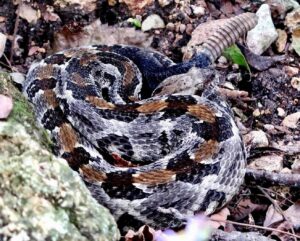
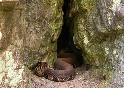
Safety is important while visiting Snake Road. Snake Road is home to three venomous snakes including copperhead, cottonmouth (water moccasin) and timber rattlesnakes. Seeing a rattlesnake is often described as being rare but seeing a cottonmouth is very common. In fact, chances are, you will see more cottonmouth than any other snake. This means that you will encounter venomous snakes more than non-venomous snakes. While the cottonmouth usually has more “bark” than bite, it can still bite you and cause serious medical concerns. You will likely have enough time to reach medical service after getting bit unless you have an allergic reaction to venom, then it can be immediately life threatening. With that being said, please use caution when approaching any snakes on Snake Road. See the photos below to help identify the three venomous snakes found on Snake Road.
Copperhead
Snake
Cottonmouth
Snake
Timber
Rattlesnake
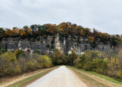
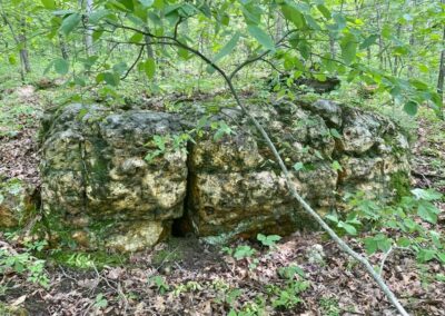
A word of caution needs to be addressed to those who decide to venture around the bluffs at Snake Road. Unlike much of the east side of the Shawnee National Forest, the bluffs around Snake Road and LaRue are made up of mainly limestone. This means that the rock is very flakey and breaks off easily. If you are attempting to climb or get footing on the bluff, it could break apart and cause you to fall. If you fall, it could seriously injure to even kill you. The user trails around the bluff are not maintained by anyone either because they’re considered illegal trails. The conditions of the trails are rugged, steep, and often have dangerous spots where you could easily fall. A venomous snake could also be hidden within the elements and you might get bit if you step on it or spook it. There are a number of hazards that you increasingly face by going off designated trails within the Snake Road area – are the dangers worth it? I’ve seen hognose, rattlesnakes, mud snakes and the rarer snakes all by staying on the road and I suggest you do that, too!
The best way to visit Snake Road is by foot and on the road itself. You should watch every step you make as smaller snakes may be present and you don’t want to step on them. Snakes like to sun on the road often, so it is important to look for them there. Snakes also tend to blend in with the road, especially the venomous ones. Be vigilant about walking the road. I would not suggest bringing pets as they risk getting bit. Don’t let small children run free as they too will risk getting bit. CYCLISTS – please avoid using Snake Road during migration, it is illegal for starters, but you risk harming wildlife and making even more people hate us (Yeah, I’m a cyclist too!). Walk slowly, look around and enjoy the area!
Snake Road is not just home to precious wildlife. Special and rare plants, orchids, wildflowers, and botanical elements also occur there. This is why it is important to tread lightly and practice Leave No Trace, to help preserve this special place and its special elements. Please pack out what you pack in and help us keep Snake Road clean. Littering even fruit peelings is a risk to wildlife at this particular area. Please help protect the wildlife and special elements of this place by being an ethical visitor. And remember to Recreate Responsibly when visiting Snake Road.
To meet other fans of Snake Road and find road walking buddies, I encourage you to join the Facebook group LaRue Pine Hills Snake Road which is a Hiking with Shawn community.
Snake Road Gallery
Enjoy some of my best Snake Road videos and photos below!
Otter Pond:
Otter Pond is south of the South Gate for Snake Road. You can access it from the end of Forest Service Road 345A (Length: 0.5-miles). This forest road appears to be open to motor vehicle use and is routinely maintained by the Forest Service. At the end of the road where Otter Pond is, there is an area that looks appropriate for canoe/kayak launching. About 0.3-miles into the road, you will see a small shelter on your left and if wet, a waterfall runs through it. This area is former settlement and there is evidence of a covered well at this location. Do note that a beaver has recently dammed the area and much of the roadway past this point is under water. Also note that the beaver is a protected form of wildlife in this area just for your information. During the spring, you can find many daffodils blooming along this road as well.
White Pine Trail:
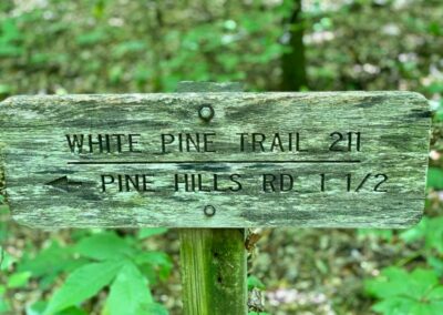
The White Pine Trail (directions above) is located on the upper end of LaRue Pine Hills. There are two trailheads for this trail. The south trailhead is located at Pine Hills Campground. Public parking is available near the restrooms. The north trailhead is up the road from the campground and has parking for about 2-4 vehicles. A little bit up the road, there is an area off the side of the road that could accompany a horse trailer or two. The White Pine Trail is a 4.6-mile (out and back) trail for both equestrians and hikers. If going out and back point A to point B and back to Point A, it will be about a 9.2-mile hike. If you hike the trail and include Pine Hills Road to make it into a loop, it will be about 7.1-miles in length as Pine Hills Road will add about 2.1-miles into the loop. There is a junction that is signed that it will take you to Hutchins Creek. That trail ends and appears to be no longer maintained.
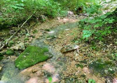
White Pine Trail is a beautiful hike but can be thick with undergrowth during the summer months. This trail would be best to travel during fall color and leaf off seasons. There are some hills along this trail and if you add in the road to make it a loop, it is about 730-foot of elevation. It took us about 3.5-hours to hike it with an hour of that simply stopping to look at wildflowers, insects, and such. Along this trail, you will see some virgin growth forest, a little bit of bluffage, a true piece of Illinois Ozarks, creeks that share the Hutchins Creek-type rock and remnants left behind from when the area was being occupied by the Civilian Conservation Corp (CCC). For a remote and lesser used trail, White Pine makes for a very nice and scenic walk through the Shawnee National Forest.
McGee Hill Trailhead:
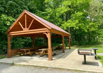
McGee Hill Trailhead (directions listed above) is a small picnic trailhead. There is enough parking for about 3 to 5 vehicles. Down the road, on the side on Pine Hills Road, there is an area that would accommodate a horse trailer or two. McGee Hill has a picnic table and a vault-styled restroom. There is a wonderful view when walking past the picnic table. It would be best utilized (for views) during the fall color and leaf off seasons. This is a very scenic spot that would for a great picnic or BBQ area. Please be sure to pack out what you pack in and help us keep our National Forest clean for everyone to enjoy.
McCann Springs Trailhead & Inspiration Point Trailhead:
Using the directions to both of these trailheads above, each of them will take you to Inspiration Point and they both offer unique features and views. McCann Springs Trailhead (1.3-miles, out and back, 200-foot elevation gain) is the long way to Inspiration Point. We went during May and the trail was perfect. This section is hilly and contains switchback trails. There is a lot to see in terms of birding, wildflowers, botanical elements, and forest. If you prefer a shorter way to Inspiration Point, you can go to that trailhead (directions above) and it will be less than a mile of hiking.
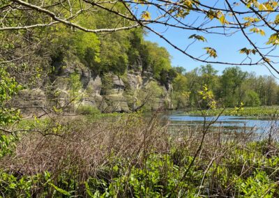
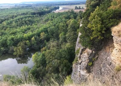
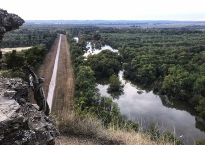
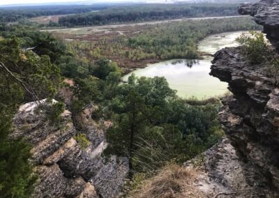
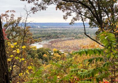
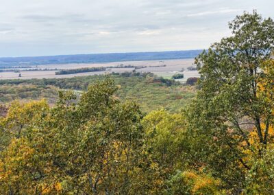
Inspiration Point, being the main feature for both trailheads, is one of the best scenic overlooks in the Shawnee National Forest. You’ll see the length of Muddy Levee Road with Snake Road to your left and the Big Muddy bottoms to your right. Please don’t throw trash down the bluff and refrain from graffiti. Activities like that could cause areas like this to no longer be maintained or even closed. Pack out what you pack in and let’s keep the forest beautiful.
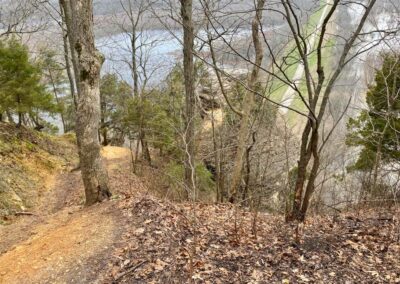
Please use extreme caution when visiting Inspiration Point. The trail down to it is steep and contains a lot of loose rock. The overlook itself is very high up and a fall will most likely result in death as there are huge jagged rocks where you would fall onto.
Godwin Trailhead (West):
Godwin Trailhead (West) will allow you access by designated trail (River to River Trail) to Clear Springs Wilderness Area as well as Hutchins Creek. This is a very nice trail with a lot to look at. It is shared by both hikers and equestrian users. On the LaRue side, you get enjoy a walk, through Clear Springs Wilderness and once you cross Hutchins Creek, you will get into Bald Knob Wilderness. There are a few ways into Hutchins Creek, but I always find Godwin Trail to the creek to be the most scenic and lesser known ways to take. This entire section of River to River Trail is actually a very scenic section of the trail and might be idea for a longer day hike or even an overnight hiking option. There are other trails in the area that are also mapped out for overnight hiking – see the Multi-Day Hiking Maps by the River to River Trail Society to learn more about these trails. Because of undergrowth and lack of use, hiking this trail during the summer months isn’t recommended. It is best to hike during late fall, winter, and early spring. Dispersed camping is allowed in the wilderness area for free as long as you follow the rules of wilderness area use.
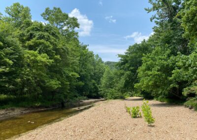
Godwin Trailhead West has enough room for about 2-4 cars to park. Taking the trail to Hutchins Creek will be about 4-miles with another 4-miles on the return trip. It would be an additional 4-miles to Godwin Trailhead East. There is a lot of Hutchins Creek that you can explore but both ends eventually go into private property. The property owner to the south has been said to be very aggressive towards trespassers. It is recommended to use a property boundary app such as OnXHunt (not sponsored) to remain on public land. This area is made up of rolling hills. Going from either trailhead will result in over 1,200-foot of elevation gain. Hutchins Creek is said to be a spring-fed creek so there is usually always some kind of water within it. When the creek is not completely full and running, there are small pockets of cool water throughout the creek that make for wonderful wading pools and swimming holes in some of the deeper ones. There are also many areas of old settlement in the area including Odie’s Place. Hutchins Creek would have to be my favorite creek in the whole Shawnee National Forest. Aside from the rocks being a little sharper, the creek reminds me of something you’d see in the Missouri Ozarks or Current River area.
Pine Hills Road:
Pine Hills Road can be accessed from the south end from State Forest Road near Wolf Lake or around Muddy Levee Road on the north end. Pine Hills Road or FSR-236 is a 7.8-mile out and back vehicle accessible gravel forest road. There are many places to stop and view scenic overlooks along this road. These overlooks would be ideal for viewing scenery during fall color and leaf down seasons. There are quite a few pull off areas, trails into the Clear Springs Wilderness and other neat points of interest such as a CCC created chimney. For quite a few years the road was closed to vehicle traffic due to wash outs. The wash outs have been fixed but in areas where guardrail is present, the road is very narrow and should be driven through with caution. This area would be ideal for a challenging bike ride using gravel bikes or mountain bikes as there is over 400-foot of max elevation gain.
There is a lot to explore within the LaRue Pine Hills area. What sort of activities will you find to enjoy while visiting this area?
LaRue Pine Hills Rules and Safety Information
LaRue Pine Hills is a very scenic area with a lot to do. But there are concerns for safety that all visitors should follow. There are also many extra rules and guidelines in place because of how special the area is. It is important that we all do our part to follow the rules and put safety before all else with visiting this amazing area of the Shawnee National Forest.
Special Rules of this area:
- Snakes and other wildlife are strictly protected here. Do not harass, harm, kill, handle, collect or even block egress of any wildlife in this area outside of permit-issued use or hunting during legal hunting seasons.
- The use and possession of wildlife collection equipment including hooks, tongs, pillowcases, collection containers, aquariums and related are strictly prohibited.
- Follow all Wilderness Area Rules when recreation in Clear Springs Wilderness Area and Bald Knob Wilderness Area.
- During snake migration, when the gates are closed at Snake Road, only foot traffic (and wheelchairs) are allowed. Motor vehicles, horses and any kind of bicycle is strictly prohibited.
- Fires may only be made is designated areas.
- Hunting may only be done during legal hunting seasons, with state licenses and in designated hunting areas only. See Illinois Department of Natural Resources for more information.
Special Safety Considerations:
- Venomous snakes are present in this area. Please use caution and watch your step at all times.
- Stay on designated trails only – user made trails harm the ecosystem of the area.
- Dangerous conditions exist in this area. The number one cause of death in the Shawnee National Forest are from falls of high cliffs and bluffs. Don’t become a fatality statistic!
- Follow basic Safety Practices in order to avoid most hazards in this area.
- Bicyclists and hikers should yield to all equestrian users and learn more about how to safely share the trail with horseback riders.
- This area has little to no cell phone signal. Please tell someone where you are going before you go and try not to recreate alone.
- This area is remote and very rural. Emergency response may take several hours before arrival. Please think about the safety of others before doing dangerous activities.
- The nearest hospital is located in Anna, Illinois.
- Always practice Leave No Trace, pack out what you pack in, and Recreate Responsibly so that everyone can enjoy the Shawnee National Forest just like you.
Other things to do and see around the LaRue Pine Hills area
There are many other outdoor recreation activities to enjoy around the LaRue Pine Hills area including hunting and fishing activities at Oakwood Bottoms and hiking at Little Grand Canyon. Camping, hiking, and horseback riding is available along the River to River Trail and at Trail of Tears State Forest.
Camping is available for free in the wilderness areas or at Turkey Bayou if the river is not above flood stage. Fee-based camping options are located at Pine Hills Campground, Trail of Tears Campground and Devils Backbone State Park. Cabin rental is available nearby at Rustic Hideaway Cabins.
Be sure to check out Bottoms Up Bar and Grill and Horseshoe Lake Bar and Grill for some delicious food and cold drinks. Remember to Drink Responsibly! Enjoy food and more at Rendleman Orchards and Flamm’s both which are nearby to LaRue Pine Hills.
Join our Facebook group, Southern Illinois Hiking & Outdoor Recreation for more information, photos and to meet others to enjoy the Shawnee National Forest with.
One last thing!
Filming the videos, taking the photos, editing everything and writing this article takes time and it’s all provided for free. Consider making a small monthly contribution to Hiking with Shawn by becoming an official Patreon supporter on Hiking with Shawn! You can also support us by purchasing official merch from the Hiking with Shawn online store. Lastly, please share this article and our videos and follow us on YouTube, Facebook, Twitter, Instagram and Tumbler for more free guides, videos, photos, contests and more!
Thanks for checking out this guide and please share it with others if you’d like to see more of them made!
Shawn J. Gossman
Host
Shawn is the founder and host of the YouTube Channel, Hiking with Shawn as well as Hiking with Shawn LLC. Shawn hikes, backpacks and visits various forested areas in the Shawnee National Forest, local state parks and other areas promoting outdoor recreational activities to obtain video to show to locals and non-locals alike. Please support Shawn’s efforts by sharing this post and leaving a comment below.

