Hiking with Shawn’s
Trail Guide Series:
Max Creek Loop
Max Creek is an interesting hike for different reasons. Max Creek, the actual creek itself is very scenic and provides a nice view. The trail offers various waterfalls and is a fun hike during different seasons of the year. The trail isn’t used as much, and chances are that it will always be a nice break from the busier trails of the Shawnee National Forest. It is a favorite hike by many, a section of the River to River Trail and a favorite for equestrian riders as well. It is also a supposed site of a Vortex. Yes, I said that right… A VORTEX!
Dangerous conditions exist in this area of the Shawnee National Forest. High cliffs, fall hazards, trip hazards, and slip hazards are all hazards that you will face. Please use extreme caution while hiking in this area especially when wet or during wintry conditions. This area is managed by the US Forest Service – Shawnee National Forest – Hidden Springs Ranger District. There are no trash services in this area so please pack out what you pack in and help us keep Our National Forest clean!
Trail Information: 3-mile Loop / Moderate / Low Elevation / Strava Recording
Area Directions and Trail Information
See this map for a list of points of interest that are in and around the Max Creek Loop trail section.
If traveling by car from Vienna, Illinois – Drive north on Route-45 from the R-45/R-146 interaction for 5.4-miles until you reach Taylor Ridge Road/Lane on your right. Turn right onto Taylor Ridge Road/Lane. Please drive slowly and use caution as there are potholes prevent on this gravel road. People live on this road so please drive carefully to show them respect. Continue on Taylor Ridge Road/Lane for 1-mile until the road ends at the trailhead.
There are no signs for the trailhead other that trail blazes. There is room for parking vehicles on the sides of the road and little field area at the trailhead. Please make sure you park in a way for others to travel and turn around if needed.
The trail is 3-mile loop with under 200’ total elevation if hiking counter-clockwise. The ruggedness is moderate due to creek crossing requirements. Wear appropriate clothing and footwear for the season and expect to potentially get wet.
Take the River to River Trail east at the trailhead where you parked your vehicle. Continue on this trail eventually going downward to the actual creek, Max Creek, which is said to be the site of the VORTEX. Cross the creek and get onto Trail-435 north of the River to River Trail. Follow for a short period and turn left onto Trail-437. You will have to cross the creek again multiple times on this section of the trail. Continue on 437 until you reach FSR-1738A which is an old roadway. Heading south, this old road will take you back to where you parked your vehicle.
It is highly recommended that you use the Avenza App with River to River Trail Bundle to hike this trail. The app is available for free for most smartphones. The bundle is also free and the map you want to use is #14 in the bundle. This app will work when cell phone signal does not work. This app follows official Forest Service designated trails and doesn’t get you lost on user made trails like other apps do. For more information, check out the River to River Trail Society.
Area Points of Interest Information
When traveling counterclockwise along the first portion of the trail (River to River Trail), pay attention within the first mile for a clearing on your left. You’ll notice bigger older trees in the clearing area. This is the location of a previous homesite. There is an open, unprotected well in this area right next to the main trail. Please watch for it and use caution as it is deep. Please leave branches in the well if present as these branches are often put into the well to give wildlife a way to climb out if they fall in otherwise, they will likely die.
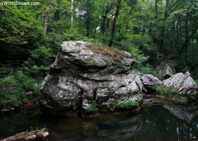
Once at the creek, notice the scenic beauty of it all. Notice the large boulders in the water and the rocky environment. It really is a picture-perfect spot so be sure to bring a camera with you. I have found that the creek is the most beautiful looking during colder months when you can see everything, and the water almost has a bluish tint to it. It really is a remarkable spot and one of the prettiest creeks in the Shawnee National Forest at least in my opinion. The creek can be hard to cross when the water is up and the rocks that you leap onto in order to cross it are usually pretty slick when wet – do be careful during your travels here and take it nice and slow.
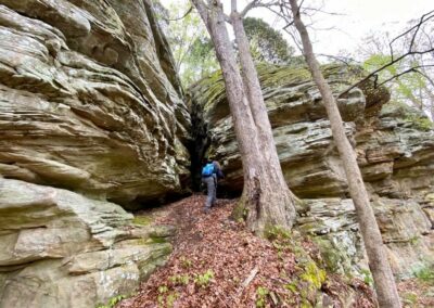
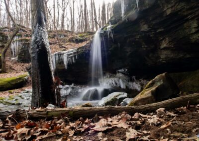
Once you are on Trail-437, look for the creek that goes away from you to your left. Hike down that creek to reach a really nice waterfall spot when we have had some good rain. The bluffage in the area is also really nice looking. During the winter when we have icicles, they’re all over the bluffage down by the creek and it makes for some awesome views.
Max Creek Vortex Legend
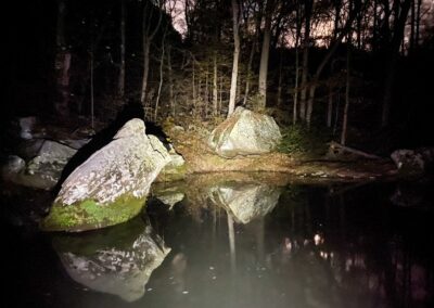
Legend has it that Max Creek is the site of an Earth Lights Vortex phenomena. Earth Lights are said to be naturally occurring balls of light (or orbs of light according to some). These lights are supposedly often seen at night, floating around by themselves and usually in a variety of colors. They are often reported when reporters claim they have encountered ghosts, haunting, demons and Unidentified Flying Objects (UFOs). Max Creek is said to be a sight of one of these Earth Lights sighting sites which gives it the name of Max Creek Vortex.
The local legend of the Vortex dates back to when early pioneers settled in the area. The was long before the Shawnee National Forest was created. It is said that the family matriarch lost her mind and murdered the husband and his children of a family that was settled there. The lights are said to be spirits of the murdered ones at the Vortex. Various reports of the lights, spirits and UFO sighting have occurred over the years in and around the Max Creek area.
From my personal experience, I have interesting things to share. First of all, I am a skeptic and I don’t really put too much belief into paranormal activities. However, I found odd circumstances the first time I visited Max Creek. I felt dramatic temperature changes and air pressure. My ears popped at one time and that had never happened on any other trail. I saw a bobcat there about 4 feet from me. It saw me and ran away. I was also semi-chased by a black racer snake there as well. The snake “appeared” to be chasing towards me but when I attempted to grab it (I like snakes), it stopped and fled. I saw no lights, but it was daytime. I have done a night hike there on Halloween and saw or heard no abnormal circumstances.
Area Safety and Important Information
Max Creek has dangerous conditions within it such as high cliffs, steep trail portions, creek crossings and rocky surfaces. Please use caution when hiking this trail. Leave with good memories, not bad injuries. Always put safety first and watch your step.
Venomous copperhead snakes have been observed occurring in this particular area.
Poison ivy occurs in this area. Some portions of the trail become overgrown during summer months. I have personally experienced massive seed tick (nymph ticks) attachment when hiking this area during the summer.
The is a shared hiking and horseback riding area. Please, always, yield to horseback riders and talk to them so that their animals know you are human and not a threat. See my Equestrian Safety Guide for more information on sharing the trail with horseback riders.
There are no trash services in this area. Please pack out what you pack in and pick up any litter that you find along the way to help us keep the trail in pristine condition. Always follow Leave No Trace practices to help keep the National Forest in a natural state.
This area is remote and cell phone signal is usually unavailable. Please try not to hike alone and always tell someone where you are going before you go. The nearest hospital to this area is more than 15-miles away and first responders are volunteers. If you become injured or lost, response time could take several hours.
I want to give a big shout out and thank you to Jimmy Bruce for his commitment and stewardship of basically adopting and taking care of this particular area.
Max Creek is said to be a Vortex site. Be careful… Don’t get haunted, possessed by demons, or abducted by space aliens. If you see Bigfoot, feel free to come say hello to me!
As always, remember to Recreate Responsibly so that other visitors can safely enjoy this area as well.
Area Nearby Attractions and Communities
This area is close to many other outdoor recreational opportunities including hiking, kayak/canoe/boating, fishing, and waterfall chasing at Dutchman Lake. You can also hike and chase waterfalls at Bulge Hole Ecological Area near this location as well. Check out Tunnel Hill State Trail for cycling adventures. To see wildlife such as birds, reptiles, snake, and other critters – visit Heron Pond Preserve located near this area.
Visit the nearby community of Vienna for more attractions including dining at Wildfires Steak House, Ned’s Shed, Family Pizza and the Vienna Diner. Visit Vienna City Park for family outing as well as access to a 45-mile Rails to Trail bicycle and pedestrian path. Visit the Vienna Welcome Center for things to see and learn about around Vienna and southern Illinois.
For lodging – there are many options available around this area. You can stay in an Airbnb nearby at Shawnee Paradise in the Lake of Egypt area. For tent camping, we recommend Red Bud Campground attached to Bell Smith Springs. For dispersed wilderness camping, check out Burden Falls Wilderness and Bay Creek Wilderness. In Vienna, for electrical camping, check out Shawnee Forest Campground. Vienna also has Hotel 7 for those who wish to stay in a hotel. For equestrian camping, we recommend the nearby Hayes Canyon Campground.
Watch the videos for the Max Creek trail!
Below is a recent video that we filmed while enjoying this area.
One last thing!
Filming the videos, taking the photos, editing everything and writing this article takes time and it’s all provided for free. Consider making a small monthly contribution to Hiking with Shawn by becoming an official Patreon supporter on Hiking with Shawn! You can also support us by purchasing official merch from the Hiking with Shawn online store. Lastly, please share this article and our videos and follow us on YouTube, Facebook, Twitter, Instagram and Tumbler for more free guides, videos, photos, contests and more!
Thanks for checking out this guide and please share it with others if you’d like to see more of them made!
Shawn J. Gossman
Host
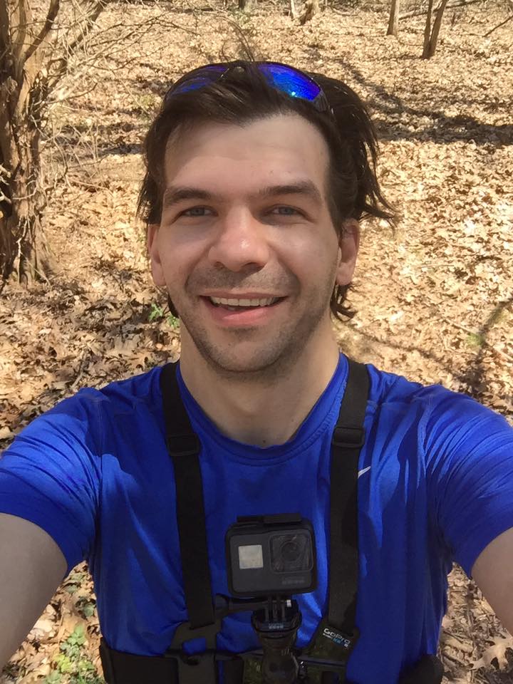
Shawn is the founder and host of the YouTube Channel, Hiking with Shawn as well as Hiking with Shawn LLC. Shawn hikes, backpacks and visits various forested areas in the Shawnee National Forest, local state parks and other areas promoting outdoor recreational activities to obtain video to show to locals and non-locals alike. Please support Shawn’s efforts by sharing this post and leaving a comment below.

Trackbacks/Pingbacks