15 Southern Illinois Fall Color Spots for Fall 2024
Are you looking for Southern Illinois Fall Color Spots to visit this fall?
There are so many throughout the region that it’s hard to choose just one. But I’m here with 15 awesome spots for you to choose from or even tour.
I’ll show you where to go, how to get there, how hard it will be, and other things to do around the area, such as local restaurants, nearby attractions, and additional hiking trails.
Here are 15 of my favorite Southern Illinois Fall Color Spots, each offering a breathtaking display of fall colors, ready for you to explore this fall.
When to Visit Southern Illinois Fall Color Spots
Now!
As of this blog post, now is the time to visit Southern Illinois fall color spots around the region. The month of October is when all the magic happens. But because of drier weather earlier in the year, the colors will be fast.
Even if this isn’t the greatest year to see them, you’ll still be able to see some colors.
So be sure to get out there and check them out if you can.
These spots are also cool to see during leaf-off months, which typically occur in late fall or early winter. During these months, you’ll be able to see the unique rock formations and landscapes that are hidden by foliage in other seasons, and that’s cool to witness, too.
Remember, safety comes first. While these spots offer stunning views, some are high, and falling can be dangerous. So, be cautious, watch your step, and use common sense. We want you to enjoy these spots safely and return for more adventures.
I’m breaking this up into three sections: West, Central, and Eastern Southern Illinois.
Southern Illinois Fall Color Spots (West)
The following Southern Illinois Fall Color Spots are located on the western side of the state around Wolf Lake, Pomona, and Murphysboro.
1 – Chalk Bluff at Little Grand Canyon
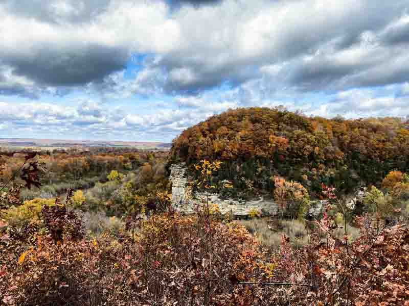
Chalk Bluff is an overlook at Little Grand Canyon, where you can see the Big Muddy River bottoms. You can also see more bluffage along with beautiful forests.
Go to Little Grand Canyon and start hiking the trail by the restroom area. Hike about a mile or so, and you’ll get to the overlook. There is a sign for it, but you’ll know what it is when you get there. You don’t have to do the hard part of LGC if you go this way.
Aside from a few rolling hills, this hike is fairly easy to do. It doesn’t take you into the waterfall portion of the trail (which is rugged) as long as you go in by the bathroom. If you go in the other way, you’ll have to do the full trail (might be what you want).
For more hiking nearby, I suggest checking out Pomona Natural Bridge.
2 – Horseshoe Bluff in Pomona
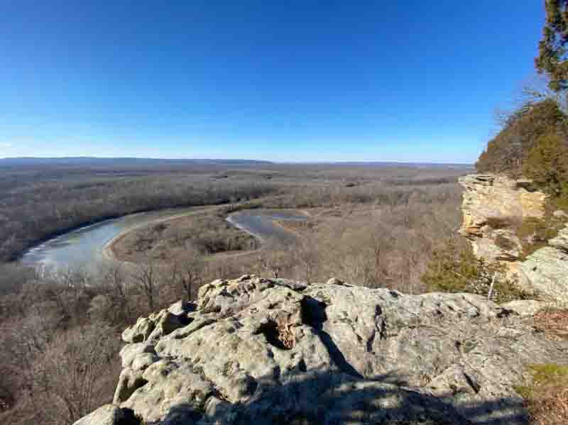
Horseshoe Bluff is south of Little Grand Canyon. It features an amazing scenic overlook where you can see the bend of the previous section of the Big Muddy River. The river changed course, and this section is now an oxbow lake.
This area is very backcountry. Take these directions to Haggler Road. Take Haggler Road (gravel, could be rugged at times) to the parking area at the end of the road. You need a good map or app to get to the overlook at N37 39.603 W89 24.523.
This is a very rugged hike. There are rolling hills and very steep terrain. It isn’t a beginners’ hike, and most of it will be off trail.
For more hiking in the area, check out Little Grand Canyon.
3 – Inspiration Point at LaRue Pine Hills
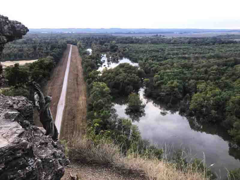
Inspiration Point is a beautiful overlook of the Big Muddy River bottomlands and Winter’s Pond area of LaRue Pine Hills. It is over 300 feet high, and people have died from falls here, so please use extreme caution.
From Route 3, take Muddy Levee Road until you get to the T. Turn left onto Scatters Road and then take your first right onto Pine Hills Road. The first Trailhead on your right is the long way UP to the Point. The second Trailhead as you drive up the road is the short way to the Point.
Overall, the trail is relatively easy to hike, with some rolling hills. Getting down to the Point can be tricky, so use extreme caution.
If you want a great hike nearby, check out the White Pine Trail up the road.
4 – McGee Hill at LaRue Pine Hills
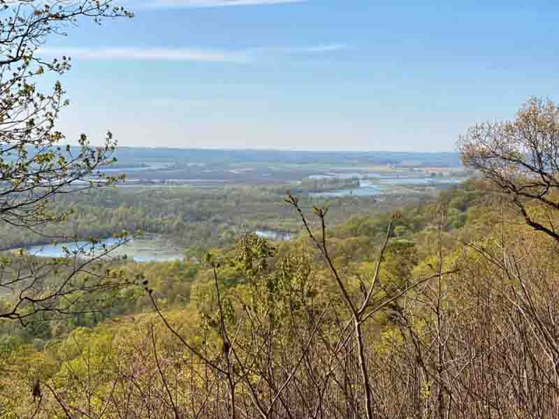
McGee Hill is a picnic area on the upper portion of LaRue Pine Hills. It features a beautiful overlook of the area and Big Muddy River bottoms. There are also picnic tables and a restroom at this location.
Drive up Pine Hills Road to this location and turn into the picnic area.
This is a very easy overlook to get to.
If you want to keep hiking nearby, check out Trail of Tears State Forest.
5 – Cliff View Park in Alto Pass
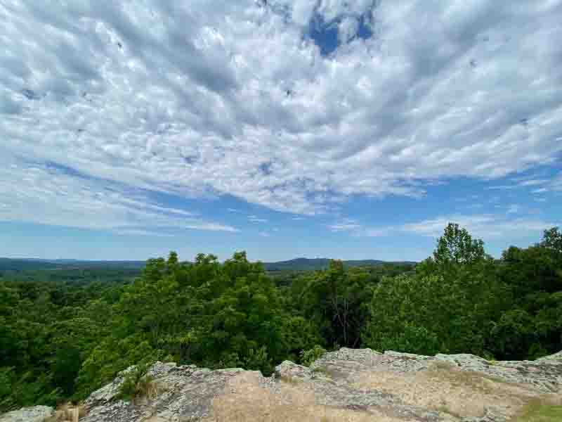
Cliff View Park is a beautiful little park on the edge of Alto Pass, Illinois. It features a beautiful overlook of the Bald Knob Wilderness area. You can also see the amazing Bald Knob Cross of Peace at this overlook.
Follow these directions for an easy trip through Alto Pass to the Cliff View Park overlook. Be sure to check out Alto Pass for more cool stuff.
This is very easy to overlook. You don’t even have to get out of your car to see the amazing scenic overlook and colors,
For easy hiking, check out the Quetil Trail right below the overlook.
Southern Illinois Fall Color Spots (Central)
The following locations focus on Southern Illinois Fall Color Spots in the central part of the region around Makanda, Vienna, and Eddyville.
6 – Post Oak Overlook at Giant City State Park
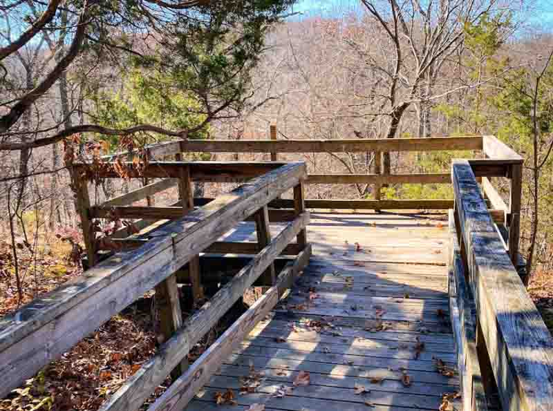
The Post Oak Overlook is on the ADA certified hiking trail Post Oak at Giant City State Park. Hikers and wheelchair bound adventurers can reach this overlook for amazing views of the fall colors and bluffage in the area.
The trail is very easy to reach. Follow these directions to the water tower, which is right next to the Giant City Lodge, which has great food.
This is an easy viewing area, but you must climb quite a few stairs to get to it.
If you’re looking for something to do afterward, check out the many great trails at Giant City State Park.
7 – Blackjack Oak Trail at Ferne Clyffe State Park
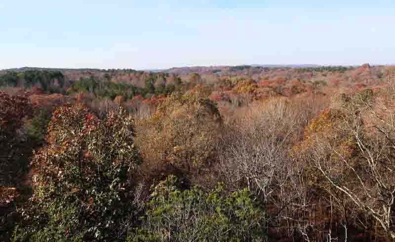
This has to be one of my favorite trails to hike for viewing fall colors. You can see Ferne Clyffe Lake and much of Southern Illinois at multiple points of this trail. And even as much as I promote it (which is a lot), I rarely see people there.
This trail is at Ferne Clyffe State Park, but most people miss it. To get to the trail, park at the Lake and cross the road.
This trail is moderately difficult. There are some steep hills and rocky terrain, and it can be slick when wet on some parts of the trail. Please use caution and carefully hike this trail.
While you’re at Ferne Clyffe State Park, check out other trails in the park for more hiking adventures. The end of Blackjack Oak will get you to several shorter trails to make your hike longer.
8 – Overlook Trail at Wildcat Bluff Natural Preserve
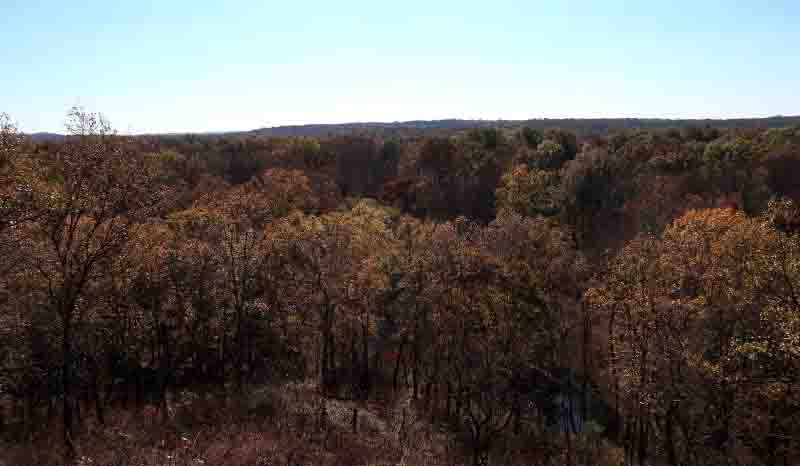
The overlook trail at Wildcat Bluff Natural Preserve is probably the best scenic overlook in the area. From here, you can see the bottomlands of the Cache River, which is a nice place for photos.
Drive to Wildcat Bluff. Walk down to the Trailhead (with the sign kiosk) and then go to your left. The hike is about a mile out and back.
This trail is very easy to hike and relatively flat.
While you’re there, check out the trail to your right of the sign kiosk. It can lead you to Cache River (you can cross it if it’s not too high) and even an old cabin.
9 – Rocky Top at One Horse Gap
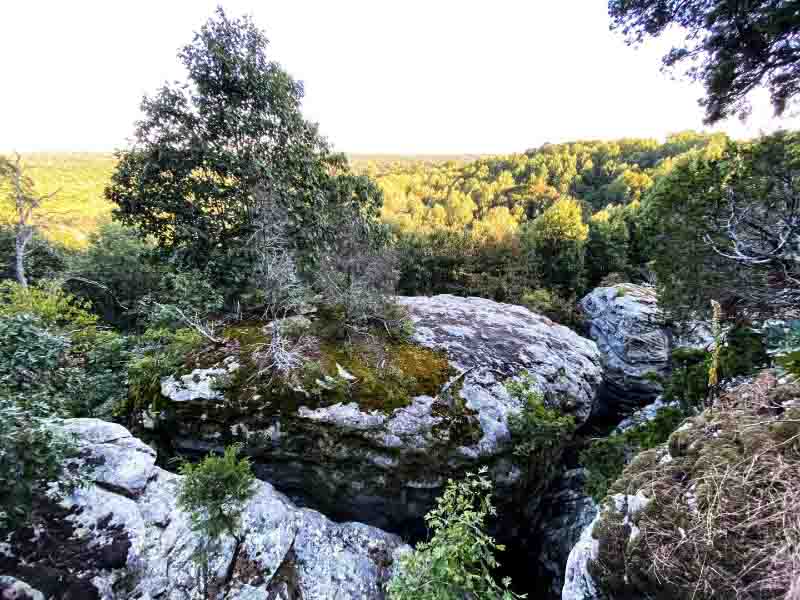
Rocky Top features an amazing scenic overlook of the One Horse Gap Lake area. You can hike to this location or even ride horses.
Here are driving directions to the area to pull over to go to Rocky Top. There is a wide trail that looks like you can drive down it. Hike it (it’s illegal to drive on it) for a short distance to reach the overlook.
This area is moderately difficult to hike in. If you encounter horseback riders, please yield to them and talk to them in your normal voice so that the horse or mule knows you’re human and not a threat.
I recommend hiking from Benham Hill Trailhead to One Horse Gap and then to Rocky Top. I always take the road back afterward. It makes for a very long but very scenic hike.
10 – Owl Bluff at Lusk Creek Wilderness
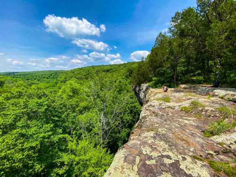
Owl Bluff is a beautiful scenic overlook in the middle of the Lusk Creek Wilderness. This roadless area is only accessible by hiking or horseback riding. It’s one of the most scenic overlooks in the Lusk Creek area.
I recommend parking at the Lusk Creek Trailhead and using the Avenza Multi-Day Trail Bundle app to get to Owl Bluff.
This area is moderately difficult to hike in. If you encounter horseback riders, please yield to them and talk to them in your normal voice so that the horse or mule knows you’re human and not a threat.
Lusk Creek Wilderness has many different trails and possible loops. I suggest hiking this area and enjoying everything it has to offer.
Southern Illinois Fall Color Spots (East)
These Southern Illinois Fall Color Spots are located on the eastern side of the region around Harrisburg, Karbers Ridge, and Equality.
11 – Power Line Overlook at Stoneface
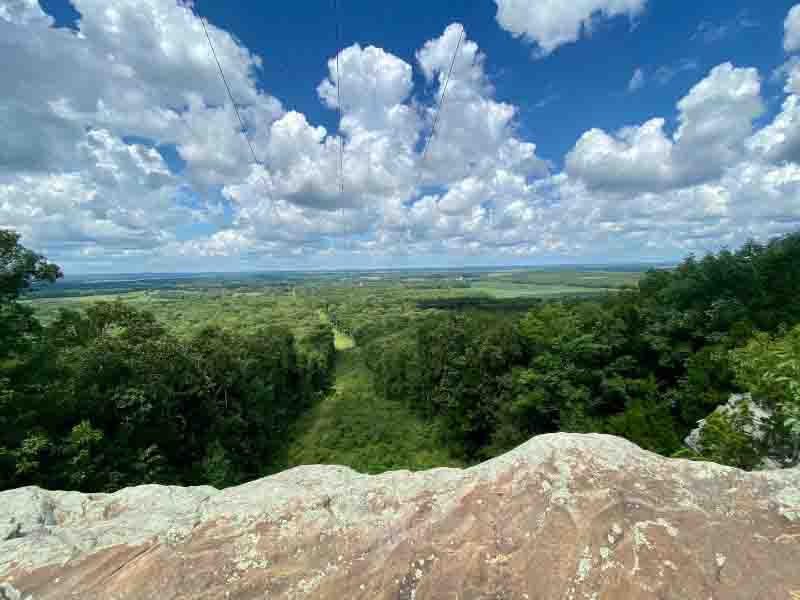
The power line overlook wouldn’t have been made without a power link right-of-way. Although the power lines aren’t natural, the overlook is still an amazing sight.
This overlook can be reached by hiking past the Stoneface formation. It’s not a long hike and doesn’t add that much more to your overall hike if you start at Stoneface.
This is a fairly easy hike with some steep hills and rocky terrain. It would be moderately difficult, but I find it to be easier than most moderately difficult hikes. Please use caution around the edge of the overlook, though.
Go check out Glen O Jones Lake nearby. There are more hiking and kayaking opportunities and even a bike trail.
12 – Christmas Star Overlook in Garden of the Gods Wilderness
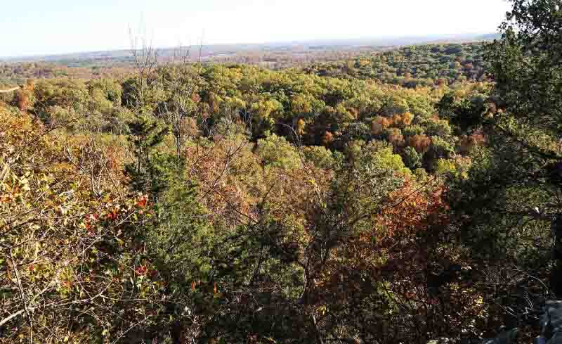
This is my favorite scenic overlook on the east side of the Shawnee National Forest. It features a beautiful view of the Garden of the Gods Wilderness. You don’t see all the rock formations like you do on the Observation Trail, but you also don’t see all the people.
You need to drive to the Hitching Post/Eagle Creek Trailhead. After you park, hike across the road to enter the wilderness. Stay on the River to River Trail for a few miles, and you’ll start reaching several different scenic overlooks.
This area is moderately difficult to hike in. If you encounter horseback riders, please yield to them and talk to them in your normal voice so that the horse or mule knows you’re human and not a threat.
While you’re in this area, consider checking out Big H. It’s a really cool area featuring a unique rock formation.
13 – Indian Point at Garden of the Gods
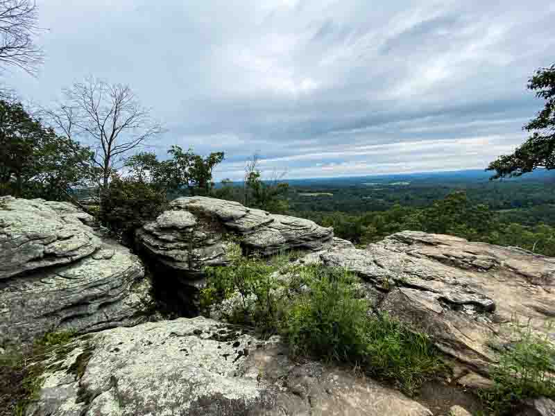
Indian Point features a few really scenic overlooks of the Garden of the Gods Wilderness. It’s also less crowded than the Observation Trail, but people also enjoy camping there.
Drive into the Garden of the Gods Recreation Area and look for the Backpacker Parking Area on your left. Park there and go into the wilderness. The loop is a little over 2 miles. You can only hike or ride horseback beyond the wilderness signs.
This area is moderately difficult to hike in. If you encounter horseback riders, please yield to them and talk to them in your normal voice so that the horse or mule knows you’re human and not a threat.
You can check out the Garden of the Gods Observation Trail nearby for more amazing views of the fall colors and unique rock formations.
14 – High Knob Overlook at Karbers Ridge
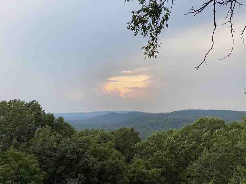
This overlook features a beautiful view of the High Knob area of the Shawnee National Forest. It’s also a very special place for me because it’s where I got married to Michelle.
This scenic overlook is at the top of the High Knob picnic area. Take Karbers Ridge Road to High Knob Road. Take High Knob until you can turn right to go into High Knob Horse Camp. The road is public, and anyone can use it, but please drive slowly for the safety of riders in the area. Drive up the road (can be rugged at times) to reach the overlook.
This is a very easy to get to overlook. You simply drive up the knob to the parking lot and walk a few feet to the overlook. It used to be a fire tower location, but the fire tower has been long gone for many years.
Consider doing the short High Knob Loop Trail. There are amazing cracks in the bluffage to explore and rock formations. The trail is for hikers only.
15 – Barrens Overlook at Rim Rock
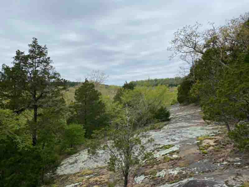
The Barrens Overlook is a beautiful scenic overlook located on the top portion of the Rim Rock National Recreation Trail. It offers amazing views of the forest, and if you angle your camera right, you can include the rock barrens in the shot, too.
Drive to the Rim Rock Trailhead. Take the trail to your left (or the middle one to make it a loop on top) and hike until you see the barrens beside you (on your left). Step onto them and follow them up to see the overlooks. Please use caution and common sense here.
This is a pretty easy hike with no real obstacles other than some rocks and roots.
Hike Rim Rock to the bottom and then hike to Pounds Hollow Beach. The whole area is very scenic and beautiful during fall colors.
Final Thoughts About Southern Illinois Fall Color Spots
That sums up my Southern Illinois Fall Color Spots for the fall of 2024. I hope you have enjoyed this article and that it has given you some new places to check out the colors. Remember to practice safe hiking and common sense when visiting these areas.
If you’ve enjoyed this article, please share it with other hikers that you know. You can also buy me a coffee for writing it or become a monthly supporter if you’d rather do that. But if you can’t, I totally understand.
Please consider joining my FREE and growing online community, The Hiking Forum. We discuss hiking and backpacking from around the world, and I really need your help growing it. As I said, it’s free, and there are no annoying ads, either.
If you haven’t already, subscribe to my free monthly newsletter for more hiking tips, trips, and local events.
And until next time, I’ll see you on the trail!
Please Support Hiking with Shawn
Alrighty folks, I hope you have enjoyed this content. I provide it for free and it takes a while to create. If you would be so kind enough to support my efforts, you can do so by sharing this post with others, especially on social media. Be sure to subscribe to my YouTube Channel to see my latest videos, shorts and live streams. Follow me on Facebook, Instagram, Twitter and TikTok for unique content that you will only find on those pages. You might also join my Southern Illinois Hiking & Outdoor Resources Group on Facebook, too!
You can also support me by becoming a Patreon Supporter for as little as $3/month and you can cancel anytime (no contracts or catches). Patreons get access to extra features, exclusive articles, sticker packs, gifts and more. Consider buying official Hiking with Shawn Merchandise as another way to support me. I spend a lot of money on Hiking with Shawn and because of extremely high public land permit fees, I make very little money in return so everything helps.
Thanks again for checking out another one of my articles and until next time, I’ll see you on the trail!
Shawn Gossman
Founder, Hiking with Shawn
Howdy folks! My name is Shawn Gossman and I founded Hiking with Shawn. I’m an avid hiker, cyclist and outdoorsman here in the Shawnee National Forest. I was born and raised in Southern Illinois and never want to leave. Click here to learn more about Shawn Gossman

